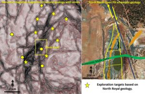
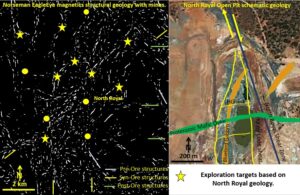
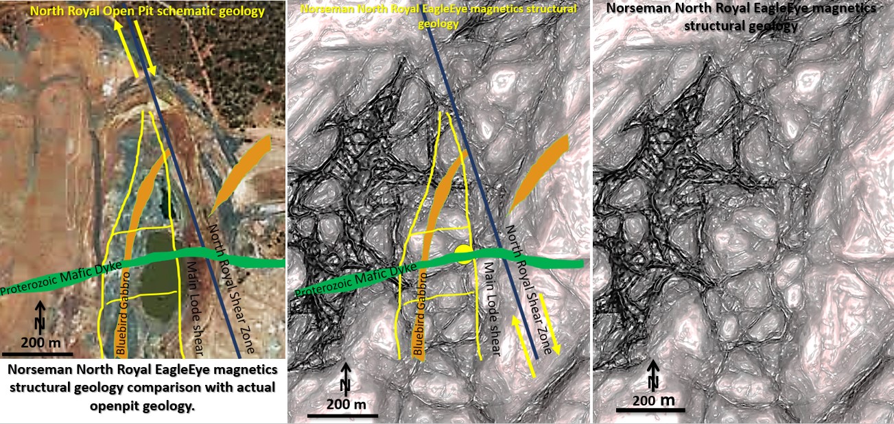
Figure 6n. Norseman EagleEye magnetics correlation with North Royal open pit geology.
Aim.
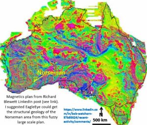
The aim of this exercise has been to examine the EagleEye structural definition system’s effectiveness at defining structures after a 20,000 times magnification, from 4,000 km to 200m scale. The structures are defined from the Australia-wide composite magnetic image in Richard Blewett’s LinkedIn post – image at end of post. Was the exercise successful?
Results.
The North Royal open pit, in figure 6n above is one area I know very well. During 1978-80 I found and drilled out the No 3 and 4 pits, worked underground at North Royal and then was the manager for Pit 2 excavation. I really do know these structures as I explored and mapped the fabulously rich, 100 g/t North Royal underground and every level of Pit 2.
I got a Google Earth image of the north end of North Royal Pit (pits 1,2 and 3, and overlaid the structures I remembered onto it ( left image).
The right image is the same scale as the EagleEye geology derived from the Australian image.
It can be seen that the;
a. North Royal fault is correctly positioned.
b. North Royal mafic dyke is correctly positioned in the pit.
c. The dextral offset on the North Royal fault is seen.
d. The Main and Footwall lodes are in approximately the correct position.
e. The flat link lodes are in approximately the right position and spacing. These link lodes are what gave the incredible grades at North Royal. In 1978 CNGC mined 143 Kt for 85 Koz.The underground production in the North Royal for 1978 (from memory) was 60,000 ounces from less than 20,000 tonnes (average ~ 90 g/t ore!).
Over the next two years the shares went ballistic. I remember at that time I had sold a house in Kalgoorlie and was wondering whether to put it in CNGC shares which were $0.80 at the time. If I had bought the shares with that $6000 in three years I would have banked $2.1 million. I built a house in Warnbro 🙁 ! As Ned Kelly said ‘Such is Life’.
Much of this mining history can be read in my book ‘Getting Shafted’ which is my autobiography up to 2009, https://www.amazon.com.au/Getting-Shafted-Bob-Bingley-Watchorn/dp/129162662X . I have kept a diary since 1962.
So, if we can pick out the North Royal lode and geological structure from EagleEye enlargements we may find another North Royal if we can find the same pattern in Norseman, or elsewhere!
Let’s look in the larger area structural geology plan for structural similarities to the North Royal structures. The area to the north of Norseman has been given an exploration hammering over the last 40 years for gold and nickel, and some has been found, but we never had ACTUAL STRUCTURAL GEOLOGY to guide us under the salt lakes. This will prove very important in new discoveries all around the world in these blind situations!

Exploration Targeting.
The North Royal exploration targeting structures are;
Late stage NS (main lode – pre and syn ore), EW (cross links – ore) and NNW fault structures (pre – syn and post ore). There is also a strong relationship of most large gold mines in the Yilgarn Craton with EW mafic dykes which are 100 million years younger. These extensional EW structures must have been active at the time of ore formation and were still active when the mafic dykes were intruded. All of this activity is post the major tectonic cratonisation of the Yilgarn Craton.
The exploration targeting stars represent areas where these structures occur together.

The EagleEye image on the left is the result of using a ‘worming’, upward continuance, edge technique and then applying strong contrast and then darkening it until just the strong structural edges are observed. This highlights the stronger, smaller and through-going structures without the general clutter and distracting magnetic gradients.
The resulting white lines are then examined for similar structural geology to the North Royal pit to generate exploration targets. From my knowledge of the exploration efforts under Lake Cowen some of these good targets have not been properly explored.
Conclusions.
The aim of this exercise, to estimate EagleEye structural definition system’s effectiveness of defining structures after a 20,000 times magnification from 4,000 km to 200m scale, has been successful. The structures are defined from the Australia-wide composite magnetic image in Richard Blewett’s LinkedIn post (Figure 1a below).

How is this EagleEye structural recognition and enhancement done?? Think of the money that can be saved and the deposits that have not been discovered because geoscientists can’t do this simple task! See https://www.geotreks.com.au/work/projects-studies/earths-evolution-the-eagleeye-system-a-brief-summary/
Cheers Bob

