Discussion with geophysicist colleagues has made me realise how different the EagleEye structural enhancement method is from their normal geophysical enhancement methods and why the geophysicists can’t yet duplicate it. However, I hope that soon this type of structural recognition software enhancement becomes just another geophysical tool. It will certainly widen horizons and promote more focused exploration research.
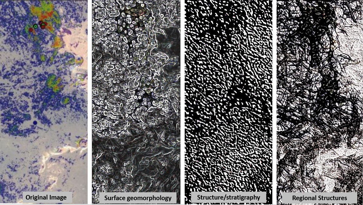
This is a continuation of the structural evaluation, using my EagleEye method, of the Neil Pendock Image from the LinkedIn post of the 21st November 2021. The images show the power and versatility of the EagleEye method in highlighting the various aspects of the geomophology, stratigraphy and regional structural geology.
The four images are as follows;
1. The original image from Neil Pendock’s LinkedIn post of the 21st November 2021 .
2. An image highlighting the surface geomorphology with some structures that obviously are very near surface and should be able to be located in the field.
3. This image highlights the underlying folded stratigraphy. A large arc is observed in the top-left and several other diffuse rings are seen on the image. The image could be enhanced to make these clearer. I have found that the intersection of these rings, linears and certain stratigraphy is the key to the location of giant mineralisation fields around the world.
So you have to be able to get these features on an image to have the best chance to find them. However; the current geophysical methods are not focused enough to outline them. Have a go at interpreting the rings in this image – they are not your mother’s face 🙂 🙂
4. This image has focused on highlighting the more regional structures. I’m not sure exactly where the image is located but if it is SE of Kalgoorlie then these structures are a good fit for those that I know exist in this area. These include the EW and ENE Proterozoic mafic dykes sets.
Once again, interpret it yourself and you will be surprised at the structures’ correlation with well reported structures. Then go out and field map and you’ll find them. I’ve done this field checking over most of the Yilgarn, Murchison and the southern Pilbara and always find them on the ground. They are real!
It is in the putting together of this geomorpology, structural and stratigraphic geology that will find the big new mining fields.
In my completely unbiased view 🙂 these images currently provide the best ultra-detailed picture of the Earth’s structure from a local to Earth-scale perspective.
Nelson Resources Limited should have fun interpreting and finding new ore with this useful combination of our two techniques. Go find some mines!
Happy Hunting
Bob Watchorn

