The AusIMM webinar I did on this new research can be seen on the AusIMM website or on https://www.youtube.com/watch?v=snu8En442Js It is preferable to listen to the above webinar before delving into these posts!
Background on research. I started my geological career with Western Mining Corporation (WMC) in 1971 in metallurgical testing slicing rocks (poor focus) into thin sections and polished thin sections (detailed focus) so we could see the details of the mineral grains and work out their intergrowths to maximise nickel recovery.
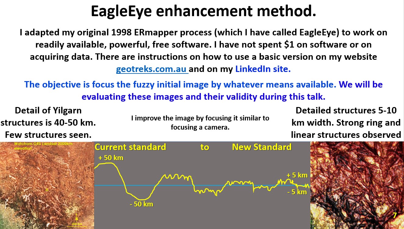
Just as in microscopic slides we need to get the plane of focus of observation as thin as possible to increase definition of structure.
Typically, with a geophysical plan, I start off with the definition (Landsat plan of Yilgarn on the left-hand side of above image) of about 50 kilometres and by many iterations I can get them down to about 5 km definition (ultra-detail) which is the plan on the right-hand side.
Successful experimentation with pattern (structural) recognition, enhancement (focusing) and spectrum sliding (reduce colour gradients) software to investigate Earth’s geological structure developed into the EagleEye system. I can now obtain ‘MRI type’ structure from most geophysical, geological, geochemical, topographical, Landsat and other images ranging from images of Jupiter to Earth’s ocean water temperature.
This is a prime opportunity for the programmers among you to get clever and optimise the software programs from other disciplines, medical scans (MRIs etc) or archaeology, to streamline my laborious process. It cannot be that hard especially with help from AI 🙂 ?
This is the link https://www.geotreks.com.au/work/giant-ring-structures/eagleeye-powerpoint-structural-enhancement-technique-watchorn/to my website in which I described some of the basic methodology of how to use EagleEye. It works, but it is not easy (like pressing a button) and not many people have the patience to work it right through and thus say it doesn’t work. Give it a try on your most prospective exploration areas to obtain their structural geology! Then go out and prove it up!!
Cheers
Bob

