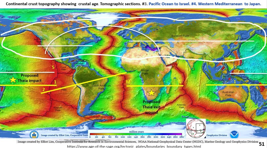
Figure 51. Seismic tomography sections from North America through Europe to Japan.
The AusIMM webinar I did on this new research can be seen on the AusIMM website or on https://www.youtube.com/watch?v=snu8En442Js
We have examined all the seismic tomographic sections of the Southern Hemisphere and noted that the lithosphere down to the Outer Core is brittle. There was no evidence of a mobile Mantle or lava-lamp type Plumes. Is this a one-off occurrence?
To find out we are now going to look at seismic tomographic sections right around the Northern Hemisphere, across the Pacific Ocean, across North America to Africa, then from Spain through Russia to Japan.
I have never seen this type of global research, down to the core using seismic tomography with structural geology, published. Have You? You will be the first to be able to view and comment on this paradigm changing research!
We will be looking at seismic tomographic section #5 which shows the Pacific floor from Borneo just about across to the Nasca plate, crossing where the proposed Theia impact occurred.
Pacific Ocean floor.
The different colours on the Pacific floor topography depict the age of the plate. The youngest is near the Nasca/Pacific Plate junction (red, still erupting) and gradually go through green through to blue (230 My) in the west.
The most obvious correlation between the Landsat Pacific floor geological structure and the tomographic section structure is in the east side. The Pacific floor is laminated from the up-welling magma forcing apart either side of the plate boundary.
Surface to core brittle structures and Plate Boundaries.
These are dramatically cut off in the centre of the figure by a steep, east dipping, NNW structure which is observed both in plan and section. I suggest that this is an internal plate boundary as the laminated structures and the linear plate boundary go right to the core.
Such close correlation of structures strongly suggests that the structures that have been defined by the EagleEye method are accurate and real. Remember, these structures have never been defined clearly before! Correct me if I am in error?
To the west of the proposed Theia impact (yellow star), there is a mixture of laminated and contorted structures both in plan and section.
This is where the major Pacific hotspot is. In the section the structures above the hotspot are all upward facing (domes), as opposed to impact structures which are all downward facing (bowls). It is suggested that this symmetry is caused by the main hotspot that is driving the Pacific Plate convection.
There appears to be an internal subduction zone in the centre of the Pacific between the two major red heat sources, shown by down-welling, blue, lithology?
Going further west, the structure changes dramatically on the west side of the northward projection of the Tonga trench to a much more contorted pattern with sharp downwardly radiating lines.
Block Tectonics.
The main thing to note is that all these structural changes occur either side of major sub vertical plate or internal plate boundaries and they are all surface to core structures. This would mean that the surface Plates are actually surface to core Blocks. Thus, I have named the new global tectonics hypothesis – Block Tectonics!
We will next look at the seismic tomographic section from North America, through Iceland to the Arabian Peninsula.
Follow and share with your colleagues!
Cheers
Bob

