Note. This paper is a transcription from the video of the AusIMM Webinar at the Western Australian, South West Branch on the 23rd February 2021. The language is thus vernacular and not geologese. This should make it more easily read and understood by the majority of readers.
The primary objective of these webinars is to promote discussion on new aspects of broad-scale geoscience and how these may change our paradigms on the structural geology of Earth, Plate Tectonics, mineral deposits and give new exploration targeting ideas.
3 South America Topography
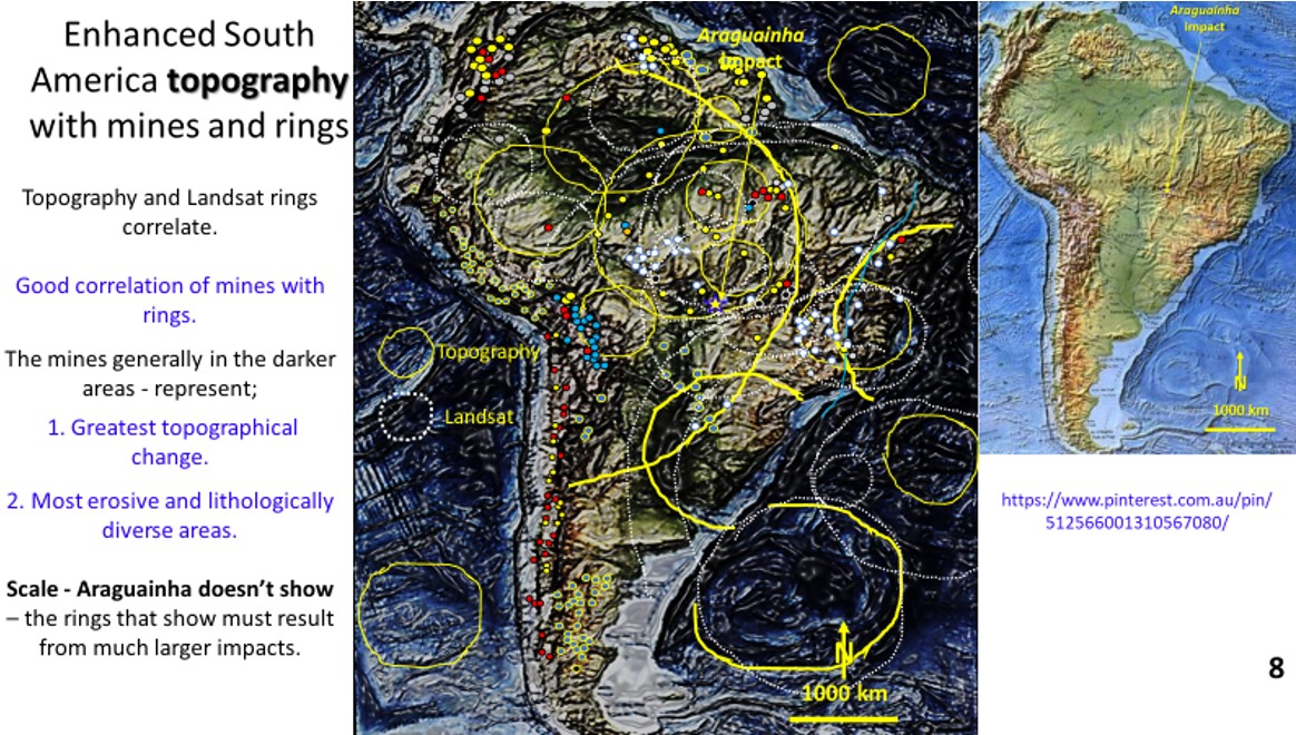
Figure 8 – see top figure. South America Topography with rings and mines (Pinterest – https://www.pinterest.com.au/pin/512566001310567080/).
This plan is of enhanced topography of South America. There is a good correlation between the Landsat rings that we have just looked at especially the large rings.
Araguainha impact does not show up in the topography.
However other impacts show up in the topography this means that Araguainha impact is much less pervasive than these large impacts.
4 South America magnetics
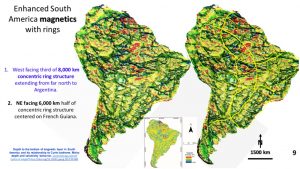
This is an enhanced magnetics plan of South America (Idárraga-García and Vargas 2018). Two large ring structures can be seen. There is an 8000 km diameter west facing concentric ring structure extending from the Caribbean Sea to Argentina. Three rings of the structure can be seen and the centre would be off the coast of Peru.
A 5000 km diameter ring structure faces to the NE and the centre is French Guyana, which is highly mineralised. The SE facing ring seen in the Landsat is also seen in the Magnetics.
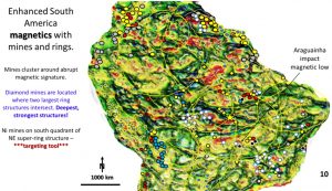
This plan of the magnetics shows the two large rings in the mines. The mines lie on the most abrupt magnetics which are the most disturbed areas which most likely contain the most magnetically variable intrusive rocks.
The diamond mines lie on the intersection of these two large rings and also within, and on the intersection, of small rings. The nickel mines lie on the southern rings of the NE facing ring structure. One would expect the diamond mines to lie on the biggest structures as they originate from 300 to 700 km down (Presser 2018).
5 South America Gravity
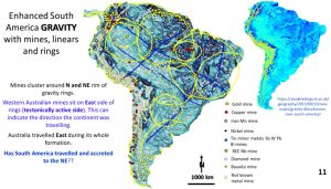
This plan shows the gravity of South America (Curtin University, 2013) with the rings, linear structures and mines overlain.
The rings aren’t as clear as in the Landsat, topography and magnetics.
The mines lie on the north and east side of the major rings and on the intersection of the rings. In Australia the mines mainly lie on the east side of the rings which was the active side of the rings (Watchorn YW #9, 2019) as Australia traveled east during its formation.
Does this mean that South America traveled north and east during its earlier formation?
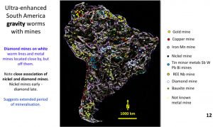
This is the South American gravity plan showing worms with mines superimposed. It can be seen that the diamond mines once again sit on the strongest, whitest worms and the metal mines lie in the dark areas.
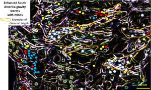
There is a strong NE, ENE and WSW trend to the diamond mines.
These worms are completely different to the ones in Landsat seen in Part 1. I see this is a plus as it gives a larger area to explore with confidence in the structural detail.
Where the Landsat and gravity target areas overlap would be the best area to explore. One needs to focus exploration targeting as this plan is about the size of Western Australia or Great Britain, Spain, France and Germany combined.
The next post (Part 3) will describe the interesting seismic tomographic research.
Share this with your colleagues especially those exploring in South America.

