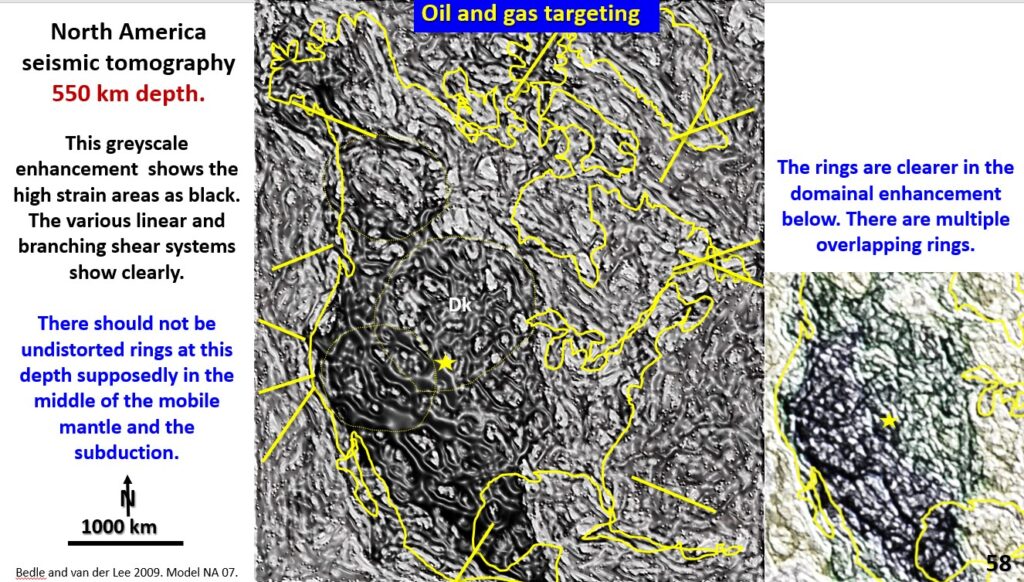
Figure 58. North America EagleEye seismic tomography at 550 km with structure.
This plan is of North America seismic tomography at 550 km depth and shows high strain tectonic areas as black ring and shear systems. The ring systems on the right-hand plan show multiple overlapping rings at 550 km depth and up to 4,000 km in diameter. There should not be giant rings under the North American continent because we are in the Mobile Mantle and the subduction zone. One thing is for sure there is no mobile mantle there.
The ring has multiple concentric rings suggesting an impact which formed very early and that the American continent formed initially as a complete continent and did not accrete as currently suggested in the plate tectonics hypothesis.
The hypothesis behind the oil and gas targeting is that gases and liquids containing hydrogen sulphide and the sulphur and different materials that facilitate the formation of oil and gas deposits will come up the same structures as the metal mineralising fluids.
Metal mines and hydrocarbons form in separate areas because hard brittle rocks where minerals deposit are not suitable for oil and gas retention.
The strong tectonic areas under the deep sediments of the Mississippi Valley up to Northwest Canada are targets for oil and gas (and MVT lead zinc deposits) in North America.
We will compare the distribution of actual oil and gas fields with the high tectonic zones.
North American ontinent wide exploration targeting for oil and gas.
Oil is produced in the high tectonic areas shown in figure 58. The productive fields appear to be largely controlled by the Lake Superior ring.
The lower right-hand plan shows the current producing oil and gas fields (white) in North America.
The rings and the orthogonal shear systems are the conduit for heat and fluids. These higher heat areas are outlined by the orange crescent shapes.
The blue ovoid exploration targets are on intersecting ring structures and the targets in the yellow ovoids are targets outside current production areas. It would be interesting to know the status of these exploration target areas?

