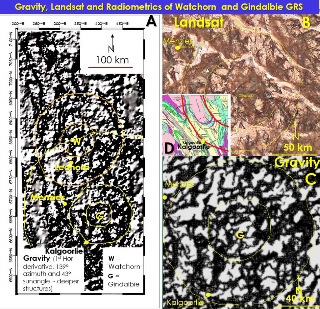
Gindalbie 140 km diameter Giant Ring Structure (GRS) correlation with Eastern Yilgarn Mineralisation. Moon Craters on Earth?
Gindalbie GRS Radiometrics of GRS separate metallogenic districts Gindalbie giant ring structure summary.
Gindalbie giant ring structure provides an earthscale examination of the underlying architecture of the Yilgarn Craton. Are there moon like craters under the Yilgarn? Do the individual GRSs define the metallogenics of the Yilgarn as seen in the radiometrics? There are many unresolved questions in all of the Archaean Cratons.
The centre of the Gindalbie giant ring structure (GRS) is located at 30˚ 22’S and 121˚59’E about 70 km NE of Kalgoorlie. The Gindalbie giant ring structure cuts across all regional geology and there is no large-scale evidence that it is a product of the regional geology. Residual gravity highlights near surface greenstones that follow sections of the Gindalbie rings suggesting that the greenstones were intruded along these rings. Gindalbie GRS can also be observed in the interpreted geology, Landsat and radiometric data. These rings correlate with the gravity rings.
The overprinting relationships of the Gindalbie GRS suggests that it is younger than both Malgar and Watchorn GRSs but is older than 2.7 Ga. However, the rings are more geologically disturbed (and harder to observe) than the rings of Watchorn, Norseman, Cauden and Plumridge. This may be because the Eastern Yilgarn – Kalgoorlie area is the last formed, thickest, surface greenstone crust and has undergone more intense late deformation and metamorphism probably because this area is at the intersection of the above giant ring structures.
The seismic traverse BMR 91 EFG 01 has been studied to understand the structures underlying the Gindalbie GRS and its possible origin.
The main exploration target areas are intersections of favourable stratigraphy and structures with Watchorn, Cauden and Norseman giant ring structures (see figure 12). New gold targeting should encompass already recognised favourable structural and lithological locii around the GRS rings, especially outside the well explored Kalgoorlie Arc. Targeting areas for nickel sulphide should follow the Gindalbie GRS median ring.
The Yilgarn wide GRS have conspicuous radiometric signatures; Watchorn and Gindalbie are pink/purple/reddish. Is this because of K alteration, which is intimately associated with gold mineralisation? Cauden, Barrambie, Malgar and Miloura have more brown/yellow/greenish Is this because of a higher concentration of thorium – which is associated with iron mineralisation?
Norseman, Yamarna suite and Paynes have a more blueish/purple radiometric signature which may mean they are more uranium enriched.
It is suggested that this observation may form the basis for using the GRS as a basis for metallogenic provinces and that this should lead to targeting for the specific associated minerals within these areas. A brief investigation of the primary mineral mined in each area suggests that the radiometric signature is defining the main mineral found in each GRS.
Happy hunting!
To read in more detail and develop new exploration strategies —- click the file below
| aaGindalbiei Giant Ring Structure and its correlation with mineralisation copy.pdf | 2 MB |

