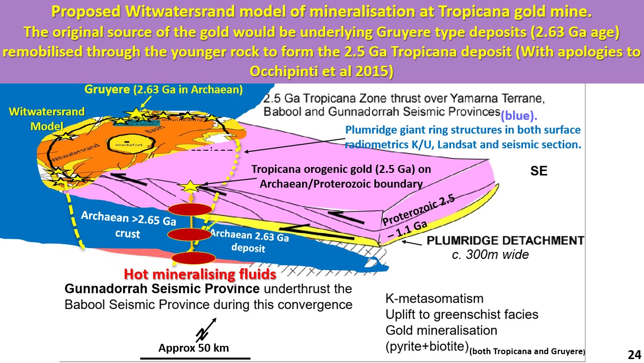
Figure 24 above. NE Yilgarn Gruyere/Tropicana Witwatersrand analogy targeting.
The webinar form which these notes are taken is at https://www.youtube.com/watch?v=bFurQYhWjyk
This figure shows a hypothetical model of the Witwatersrand. The Proterozoic Witwatersrand sedimentary basin lies on the eastern edge of the Archaean Kapvaal craton in South Africa. The gold in the Witwatersrand basin comes from erosion of the Archaean Kapvaal craton.
The Proterozoic Tropicana mine lies on the eastern margin of the Archaean Yilgarn craton in Western Australia. The Gruyere mine lies in the Archaean Yilgarn craton near the edge of the Proterozoic margin. It is a very similar geological setting.
I present this image mainly to highlight the probable fluid paths that led to the formation of the Tropicana gold mine. If the mineralisation fluids come straight up from the Outer Core complete with their heavy metal charge, then any rock that has got a lot of iron or sulphur in it will tend to deposit minerals. Gruyere is an Archaean example of that process.
However, Tropicana has a lot of the same accessory minerals as Gruyere and it is hypothesised that the mineralisation fluids came up through the underlying Archaean lithologies (following the strong Plumridge ring structures) and deposited gold in the Proterozoic lithologies above.
There is probably no real limit to how far through the Proterozoic lithologies the fluids from the Outer Core can penetrate as they have already come 2,850 km. It would still be sensible targeting way out in the deep covered Proterozoic, or later lithologies, where the strong heat flow at 300 km depth (in figure 22) indicates there is a chance of forming a deposit.
Maybe even Mississippi Valley type lead Zinc deposits (thanks Schwanny!) could be found in the younger sediments to the east?

