


Objective
1.The objective of this exercise is to see if EagleEye can produce good geology from a very basic geophysical image.
2.There does not appear to be geophysical software that can detect detailed geology from geophysical plans??
3.EagleEye uses basically free pattern recognition software and sophisticated image sharpening systems from Microsoft.
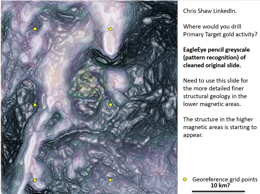
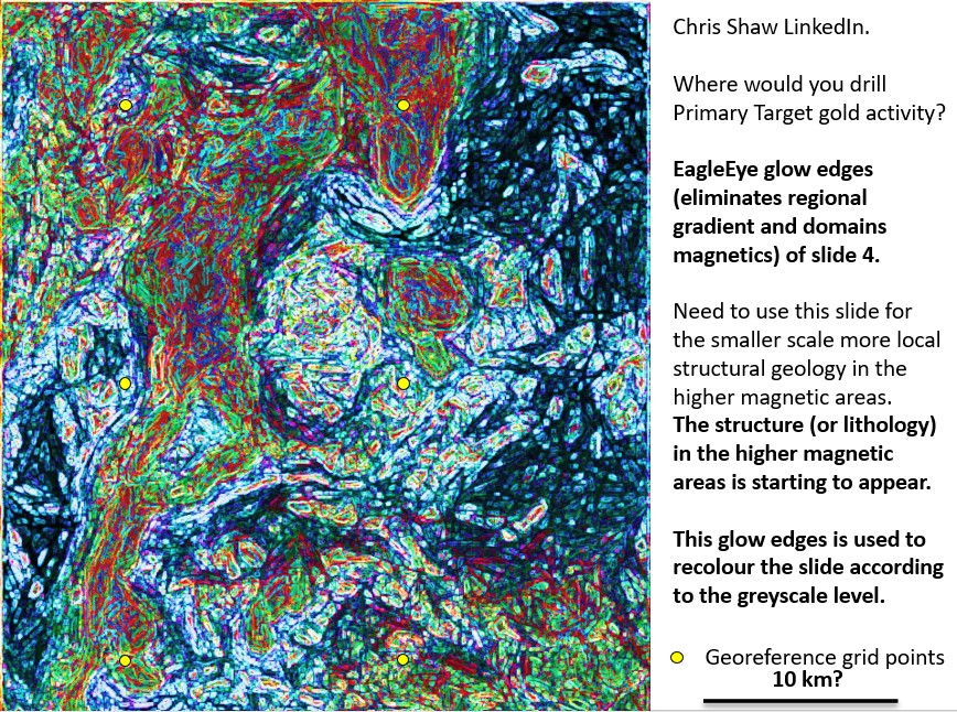
4.I will examine the image that Chris Shaw wanted targets from to see if worthwhile geology and gold exploration targets can be obtained.
5.The exercise will be presented on a PDF but I will keep the whole PowerPoint exercise so if geologists (and maybe geophysicists) are keen to use EagleEye themselves they can ask me for the PowerPoint file and it will all be there for them to study and use on their projects.
Results
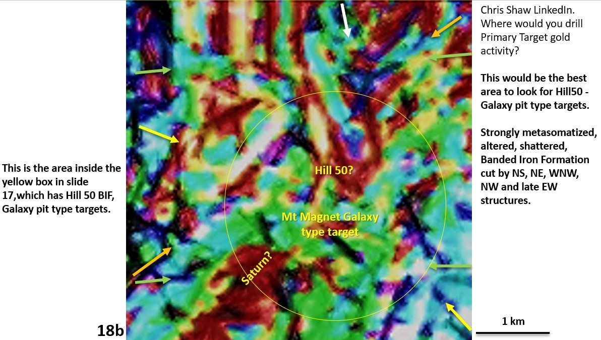
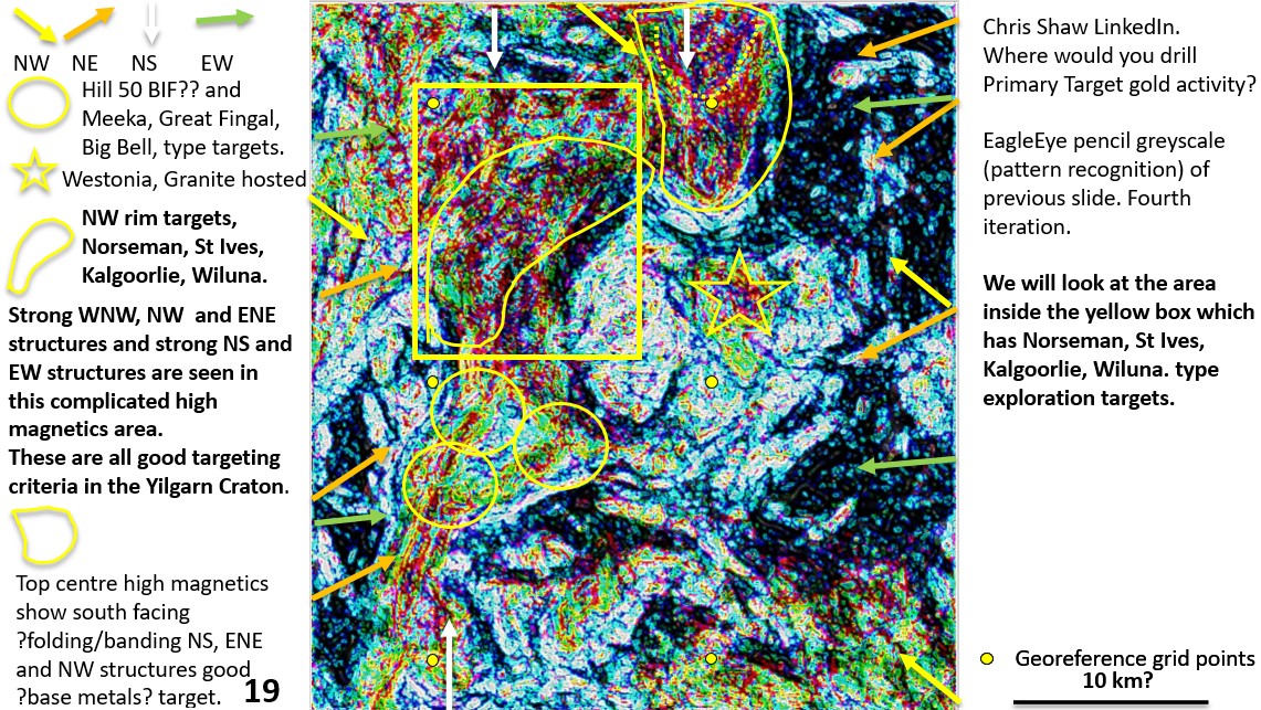
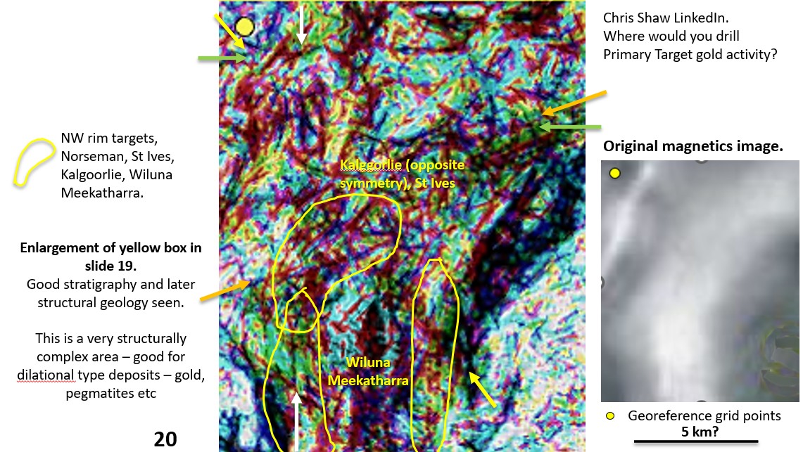
I obtained excellent structural and lithological geology over the whole area using only the original magnetics image. I was able to unravel the high magnetics into the BIFs and other rock types.
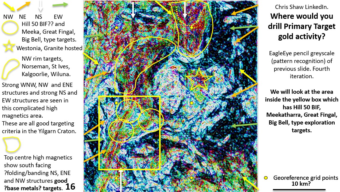
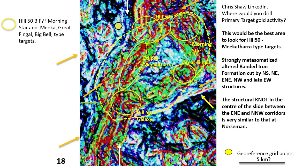
I was also able to outline good targets based on similarities with other Yilgarn Craton deposits.
Conclusions
Advantages of using EagleEye (or similar pattern recognition software if it exists) in Exploration.
1.There does not appear to be geophysical software that can detect detailed geology from geophysical plans??
2.At very low cost you can obtain this lithological and structural geology of any area, covered or uncovered, youself, at the office or home.
3.From this information you can select the best areas to explore using EagleEye information in tandem with your exploration targeting criteria.
4.When the best areas have been outlined, based on EagleEye geology plus targeted field work, you can pick up Targeted leases instead of large expensive tracts of unprospective country.
5.Before you commit to drilling you can complete a very detailed geological examination using EagleEye and other methods to target the first drillholes.
If you use EagleEye or a similar system (if one exists) you will be far in advance of your competition and pick up the best leases and explore them more effectively.
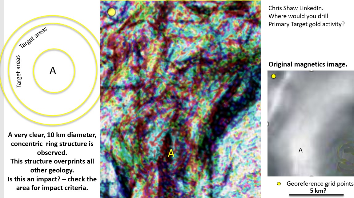
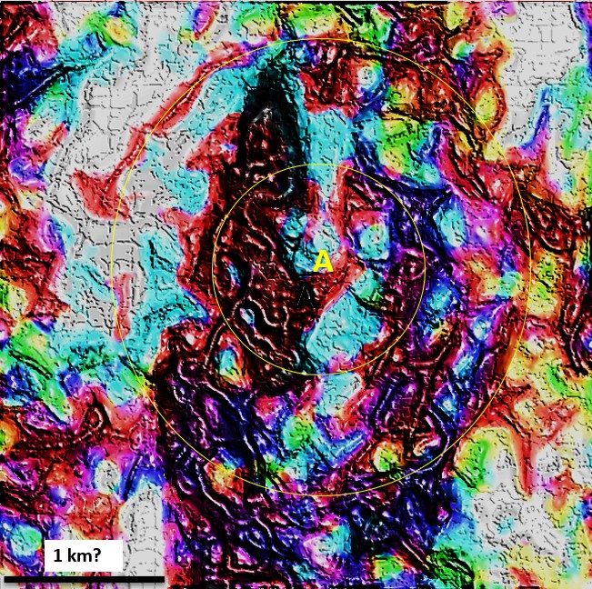
Right at the end of the investigation I discovered a 10 km diameter perfect concentric ring structure! definitely an impact of post archaean timeframe!
The following PDF file contains all of the images used in the investigation. Use fit page to toggle the images as a slide show. If any earth scientist is interested in the PowerPoint file so they can work out how I got the coloured geology from a basic greyscale geophysical image they can contact me on linkedIn.
Targeting exercise 22 2 25 v small
Homework…
If geologists (and maybe geophysicists) are keen to use EagleEye themselves they can ask me for the PowerPoint file and it will all be there for them to study and use on their projects.
Happy and successful exploring!!
Bob