1. Introduction
African research will be the subject of this next series of 12 posts of the transcript and figures from an AusIMM Webinar on 2nd September 2020 on African continent Evolution. The first two posts will set the scene and whet the appetite of red-blooded geoscientists to view the webinar. Ten more posts will complete the transcript of the webinar. Hopefully the Webinar participants will be able to have the full transcript paper to go through as they listen to the webinar.
Webinar registration is at bottom of this post.
Note. The majority of this paper is a transcription from the video of the AusIMM Webinar at the Western Australian, South West Branch on the 30th July 2020. The language is thus vernacular and not geologese. This should make it more easily read and understood by the majority of readers.
Additions have been made to expand and clarify sections that were abbreviated due to time constraints in the Webinar. References quoted in the webinar, as well as background papers referenced but not quoted in the webinar, are listed in the text and in the references section at the end of the paper.
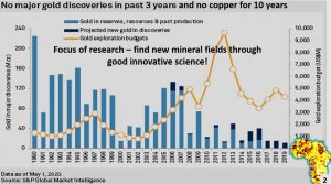
The focus of this research is to find new mineral fields through good innovative geoscience. If we don’t find any new mineral fields then the price of metals will rise and the world become a lot more expensive and less pleasant place to live in.
The focus of this African research is to find new mineral fields through good innovative geoscience. If we don’t find any new mineral fields then the price of metals will rise and the world become a lot more expensive and less pleasant place to live in.
2. African Research – surface geology
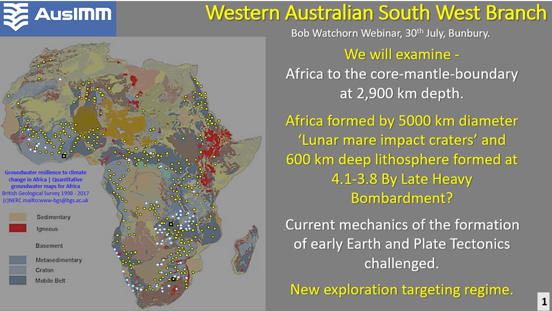
During this webinar we will examine African evolution from surface to the Core Mantle Boundary at 2,900 km depth. We will find out that Africa formed by 5,000 km diameter Luna mare type impacts and the lithosphere of 600 km depth was formed by the Late Heavy Bombardment (Taylor Redd 2017) from 4 .1 billion years to 3 .8 billion years ago.
Having observed the structural geology down to the Core Mantle Boundary we will question the current concepts of Plate Tectonics and the formation of Earth.
Africa has diverse geology (See top figure -British Geological Survey 1998 – 2017 www-bgs@bgs.ac.uk ). However, most of the continent is covered by younger rocks, generally less than 2 billion years old. The lithosphere is older than the oldest rocks in the crust (Wiemer et al, 2018, Wyche et al, 2004, Wilde et al, 2001) The structural geology of the lithosphere beneath the crust needs to be put into the equation to get a real interpretation of Africa’s geological evolution.
3. Status of Author’s research of Earth’s seismic tomography
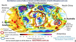
Tomographic image of the Earth showing the remaining pre 4 billion year old lithosphere as blue areas is from Schaeffer, A. J. and S. Lebedev, 2013. The Australian craton has been researched in detail from 70 to 300 km depth. The North American, Fennoscandia and North China cratons have had preliminary research.
Tonight’s talk will be on the Greater African Continental Plate which is about 5 to 6 times the area of Australia. I will be tying this work into the other continents I’ve studied around the earth.
4. Datasets used in this African research.
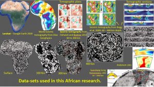
The data sets used in this research on African evolution include Landsat, World Seismic tomography by Dias Geophysics – Dublin University Schaeffer and Lebedev, 2013, seismic tomography from Fishwick and Bastow 2011 and seismic tomography from 60 – 400 km by Begg et al., 2009.
Six tomographic sections through Africa to 800 km depth were also studied (Begg et al., 2009).
A tomographic section under Africa to the Core Mantle Boundary was then studied. Yuancheng Gung and Romanowicz 2002.
A section from the Indian Ocean through Africa cross the Atlantic through South America to the Pacific Ocean by Anderson 2001 was studied last.
5. African surface structural morphology research – using Landsat from Google Earth.
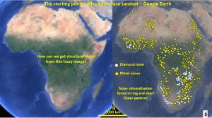
So how can we get detail from this fuzzy image of Africa (Google Earth Landsat, 2020)?
Plotting the mines onto the Landsat image it can be seen that they form rings and linear structures and there are areas containing no mines.
It was a tedious task obtaining all of the mines to plot as there is no plan on the free websites that show all African wide mines. I had to go through the various regions and compile the mines. For this reason only the main mining areas are plotted.
How do we find out where this pattern originates? The pattern does not seem to originate with any geographical features at the surface.
6. The objective and method of ultra-detailed enhancement.
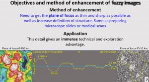
I started my geological career with Western Mining Corporation (WMC) in 1971 in metallurgical testing and we cut rocks (poor focus) into thin-sections and polished thin-sections (ultra-detailed focus) so we could see the details of the mineral grains to work out their intergrowths and maximise nickel recovery.
With fuzzy images we need to get the plane of focus of observation as thin as possible to increase definition of structure. With the above seismic tomography image I started with the plane of focus on the left-hand side image of about 50 kilometers (km) focal plane and by many iterations I get them down to about 5 km focal plane (ultra-detail) which is the plan on the right-hand side.
This is a prime opportunity for the programmers among you to get clever and duplicate the programs from medical scans (MRIs etc) to streamline my laborious process. It can’t be that hard?
For those interested in taking part in the /Webinar on 2nd September the following link will take you to the AusIMM registration.

