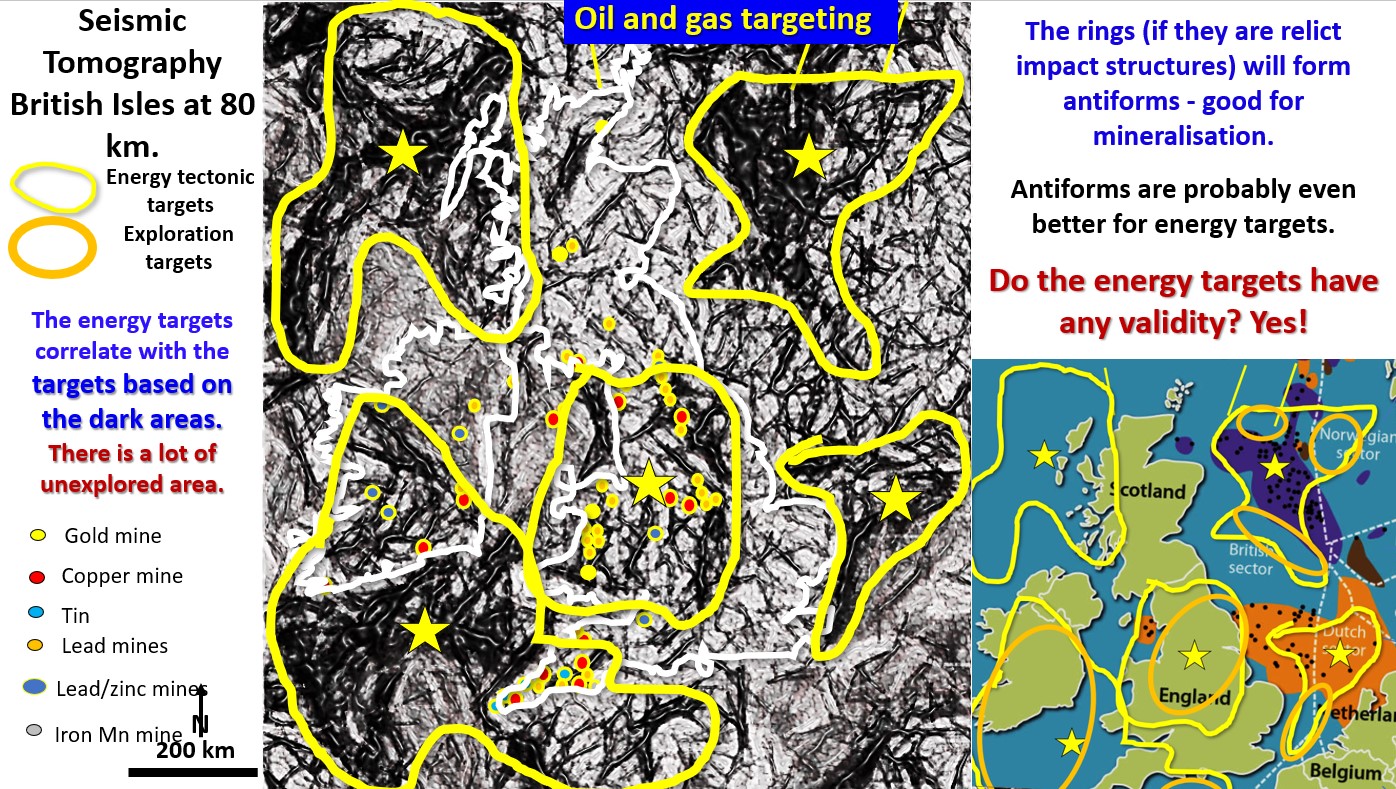
Figure 60 above. British Isles EagleEye seismic tomography at 80 km oil gas targeting.
The above figure shows the seismic tomography of the British Isles and the North Sea at 80 km depth.
Using the same criteria as those used in North America, the high tectonic dark zones (yellow shapes) in and around Great Britain are energy targets. How these targets correlate with current and past oil production around Great Britain can be seen in the lower right plan. There are a lot of unexplored areas.
As in the North American plan there is a good correlation between the high tectonic zones at 80 km depth and the oil and gas producing fields at the surface.
Great Britain exploration targets for oil and gas (orange ellipses) are those areas above the high tectonic dark zones not currently in production.
Note that the metal mines (small coloured circles) are concentrated above these high tectonic zones at 80 km depth. This is a good exploration targeting tool discussed in the Webinar on the Evolution and Geology of Europe https://www.ausimm.com/videos/community-event/south-west-wa-branchgeoscience-society—europes-geology-and-mineralisation/
and the ‘Did Copper Mining Catalyse Civilisation’ webinar https://www.ausimm.com/videos/community-event/south-west-wa-branchgeoscience-society—digital-tech-talk-geo-archaeology-correlation-between-civilisation–mining/

