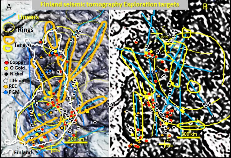
Finland seismic tomography.
This pilot study research examines the structural geology and mineralisation of Finland by comparing the surface geology and Landsat with the plan seismic tomography at 220 to 270 km depth. My investigation of current research of Finland suggests this is the first time the deep lithospheric structural geology of Finland has been observed and studied in detail.
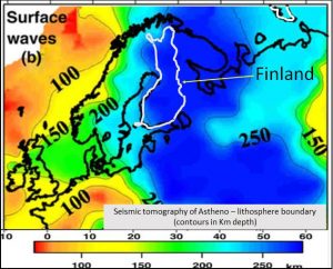
This pilot study uses a seismic tomographic plan from Cloetingh et al. 2007 which ranges from 60 to 300 km depth. This image is recording the depth of the Lithosphere/Asthenosphere boundary and thus can be modelled as a topographic plan.
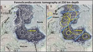
Image A. Lighter coloured giant ring structures (or potions of them) and darker linear structures are visible.
Image B. Interpretation of the stronger ring structures (yellow) and the stronger linear structures (blue). There is no correlation between the ring and linear structures and the linear structures postdate the ring structures.
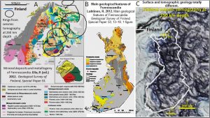
There is little correlation between the rings (interpreted from inset C) and the Scandinavian geology. The coastline of the Gulf of Bothnia (left) follows the rims of two ring structures suggesting geological activity (perhaps fracturing) was still active during the last ice age.
These structures show little deformation since the formation of the giant ring structures in the LHB. The rings are still circular suggesting the Lithosphere at least has been rigid since 3.8 Ga.
This discovery is a new finding compared to the commonly accepted belief that nearly all traces of the Hadean geology have been erased. However, the rims of the ring structures are really clear in the tomography as a paler shade (inset C).
The next section deals with whether the mines lies directly above the major rings and structures at 250 as they do in australia North America and China. Does this correlation holds true for Finland’s major mineral deposits and the structures in seismic tomography at 250 km depth?
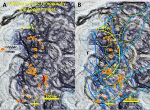
Overall there is a strong correlation of copper mines with ring structures and especially the eastern rims of C and F rings especially on the junction of multiple ring structures. There is not much correlation with linear structures.
One would think that there should be no relationship between surface mines and structures at 250 km depth.
However in Australia; in the Yilgarn, Pilbara, Mt Isa Broken Hill and Olympic Dam areas the biggest mines lie vertically above the major structures seen in seismic tomography at 300 km depth (Watchorn 2019 https://www.geotreks.com.au/work/giant-ring-structures/mineralisation-genesis-and-targeting/ ).
Also the major mines in the Abitibi belt in Canada lie right on and directly over the major structures seen at 90 km depth (Watchorn 2019 https://www.geotreks.com.au/work/giant-ring-structures/north-america/geology-north-america-300-km-depth-seismic-tomography/ ).
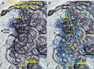
In the north there is a very strong correlation of nickel mines with the NE rim of A ring structure. In the centre the mines follow the East rim of F ring.
In the south the mines lie on the NE rim of ring C and the junction of multiple rings. The mines lie on orthogonal NE and NW linear structures and the sigmoidal linear structure which also partially follows F ring.
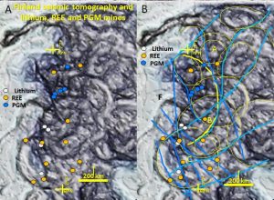
There is little correlation of Lithium REE and PGM mines with the rings apart from a few mines in the south. There is a strong correlation with the junction of NNW and especially EW and ENE linear structures. In Australia’s Yilgarn these EW structures host the last formed orebodies – it would be interesting if that were the case in Finland.
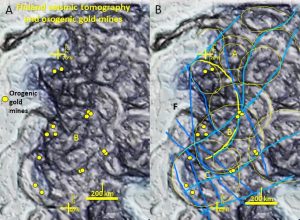
The gold mines lie inside the outer rim of the major B ring and on the ENE and NNW linears especially near where they intersect the rings. The timing of these different ring and linear structures is important to unravel the timing of the different metal deposition.
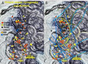
Generally the mines are clustered around where multiple rings intersect and ENE and NNW linears intersect these rings. Many of the mines are associated with the NE rim of ring structures A and C and their intersection with NNW and NE linears.
Other mines are associated with ring B. The other rings have almost no mines associated with them. Does this mean that the Rings A, B and C were better mineralised?
The correlation between mines and the seismic tomograhpy structres at 250 km. holds true for Finland’s major mineral deposits.
Possible metallogenic ring association.
Metallogenic association with specific ring impactors is seen in Australia where the Barrambie ring is host to nearly all the Yilgarn Uranium and Vanadium (Watchorn 2018 https://www.geotreks.com.au/uncategorised/uranium-vanadium-yilgarn-barrambie-grs/.
In the Pilbara the Coondewanna ring is host to all of the banded iron formation iron mineralisation and in Queensland the Isa ring hosts most of the copper mineralisation (Watchorn AusIMM October talk 2019).
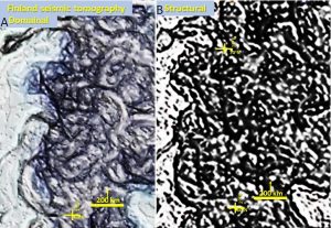
The structural enhancement is tailored to define wider, stronger structures and these are the structures seen.
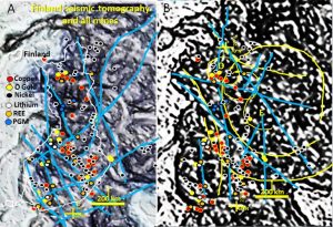
Generally the mines are clustered around the where multiple rings intersect and ENE and NNW linears intersect with these rings.
The largest number of mines is associated with outer ring E and the intersection of NNW and NW linears. Nickel mines preferentially follow NNE and NNW structures. Why? Are these the structures up which the nickel rich lavas are extruded?
Gold mines lie on NS, NNW linears close to where they intersect with WNW structures.
Formation of ring structures.
The ring structures were most likely formed in the Late Heavy Bombardment from 4.1 to 3.8 Ga and so the Finnish nickel mineralisation is 1.3 to 2.8 Ga later. It is interesting that there is still a close correlation with the ring structures. This suggests very active magmatism on the ring structures that continued over 2.8 Ga. This is a similar time period to the extended period of magmatism on the moon (Hiesinger et al. 2010). The Fennoscandian surface crustal age ranges from 0.2 to ~ 3.5 Ga (Šliaupa and Hoth 2011). The more deeply eroded areas in north Scandinavia are the oldest. The Earth’s oldest rocks occur in the lithosphere in this location in Australia and Canada (Wilde et al 2001, Wyche et al 2004, Thompson 2008). This suggests, as do conventional geology principles that the lithosphere which lies underneath is older.
The ring morphology compares to the morphology of giant impact structures on the Moon and the only period of dense impacts was the Late Heavy Bombardment from 4.1 – 3.8 Ga (Hiesinger et al. 2000, Jones 2005, Taylor Redd 2017). All evidence points to their formation by LHB impacts. The lithosphere that they impacted into has to be older and would have formed between the separation of the Earth and moon at 4.5 Ga and the earliest LHB impacts at 4.1 Ga.
These structures show little deformation since the formation of the giant ring structures in the LHB. The rings are still circular suggesting the Lithosphere at least has been rigid since 3.8 Ga.
This discovery is a new finding compared to the commonly accepted belief that nearly all traces of the Hadean geology have been erased. However, the rims of the ring structures are really clear in the tomography as a paler shade (inset A).
Exploration Targeting in Finland using seismic tomography.
To read the notes on exploration targeting you will need to open the more detailed paper below —-
| Geology and mineralisation of Finland.pdf | 3 MB |
If you find it useful share it and follow for more papers.
Enjoy and happy hunting!
Cheers
Bob

