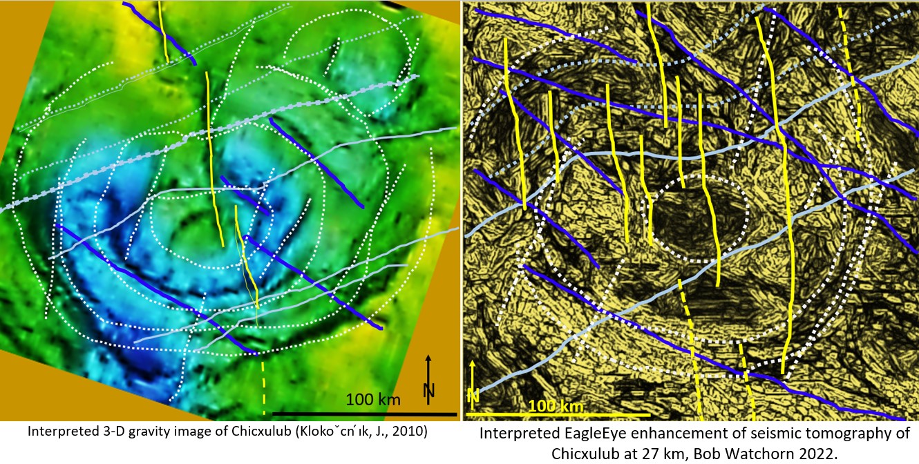
Figure 1 (above). Gravity versus Watchorn EagleEye interpretations of Chicxulub.
Question to answer.
‘One would have to question any geophysical processing method which doesn’t emphasise and even destroys the glaring great N-S trending fault structure down the top-centre of the crater.
Wouldn’t you say, BOB?’
This statement was the opening comment on the last post in which the uninterpreted 3D image of Chicxulub (Klokoˇcn ́ık, J., 2010) and my uninterpreted EagleEye enhancement of seismic tomography of Chicxulub were compared (https://www.linkedin.com/in/bob-watchorn-97b95624/recent-activity/shares/).
However, despite it’s ever so slightly negative tone, the statement shows that the commenter is starting to take my work seriously. When the commenter says I don’t emphasis the NS fault it means that my EagleEye structures are recognised as valid and in the right place – just not strong enough :)>.
See Figure 1 above for interpretation comparison of the NS fault system on both images.
The main feature to note is that the strong NS en-echelon fault, which is fuzzily, but strongly, visible in the 3D gravity, is also visible in the Watchorn EagleEye image. The NS fault’s structural geology is more clearly defined in the EagleEye image.
The above image shows that the EagleEye image of Chicxulub is a valid representation of the structural geology. I have compared the interpreted 3D image of Chicxulub (Klokoˇcn ́ık, J., 2010), which is a recognised ‘authoritative’ geophysical image, with the interpreted Watchorn EagleEye interpreted image. They show features with almost exactly the same orientation in similar places.
It is noted that there are to be expected differences as the 3D gravity image records features from a range of depths whereas the EagleEye seismic tomographic image is a clean slice at what geophysicists estimate is 27 km depth.

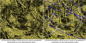
The above image (figure 2) is of the uninterpreted Watchorn EagleEye image side by side with the interpreted image. Compare the two images to check my interpretation.
I completed some structural geology research and, post impact there are 4 quite distinct deformation styles and deformation (maybe a later post?). You can have a go at structurally interpreting it yourselves – everyone picks out different details.
The gravity image is too fuzzy to be able to do much of this structural geology research. Hence the huge advantage of the clear EagleEye structures.
Conclusions on the visibility of the NS fault.
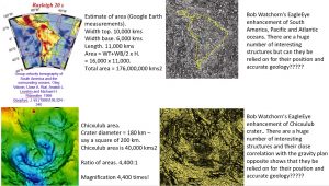
The NS en-echelon fault observed on gravity is clearly observed on EagleEye. There are other many NS structures that do not appear on the gravity survey that show that they are picked up using EagleEye much more proficiently than the gravity survey. This is despite the original data having being enhanced 4,400 times (for details see https://www.geotreks.com.au/work/giant-ring-structures/eagleeye-prima-facie-evidence-of-the-chicxulub-impact-structure/).
The EagleEye enhancement data trail is shown in the next figure.

It would be interesting experiment if those that can see (or can’t see) the NS en-echelon fault tell me in the comments on this post or post comments on LinkedIn.
For background on my research on Chicxulub follow the links below;
https://www.linkedin.com/in/bob-watchorn-97b95624/recent-activity/shares/
https://studio.youtube.com/video/-0Ee7mS18d0/edit
Methodology of obtaining an EagleEye image.
It has been requested that a more detailed manual of the EagleEye method be published. This will be coming out soon.
In the meantime follow the link to LinkedIn post to see the basics of the EagleEye enhancement method.
https://www.linkedin.com/pulse/summary-my-powerpoint-structural-enhancement-any-image-bob-watchorn/ post?
Please note that here is a world of difference between a skilled and novice operator. This skill is obtained (as most skills are) by experience. So as you are learning the method don’t be discouraged if it doesn’t seem to work at first. I can answer queries as to the method of operation for optimal results.
Exploration Targeting using EagleEye.
Whether you can use the EagleEye enhancement method or not there is a wealth of Exploration Targeting information on minerals and energy products in from Australia, Africa, North and South America and Europe in my Website (geotreks.com.au) posts.This is especially true for the Yilgarn Craton of Western Australia.
I have scrutinised when certain posts are accessed, who accesses them and when new exploration areas are taken up. Thus, I have confidence (apart from the geologists who have told me they use it) that my posts are being taken seriously by savvy geologists and are used for exploration targeting.
Successful exploring!
Cheers
Bob

