structural geology
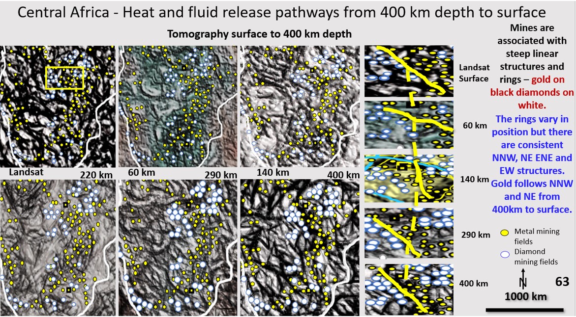
African scavenging and deposition mineralisation pathways from 400 km depth to the current surface. Bob Watchorn Webinar on Africa, Part 10.
The African Webinar can be viewed at https://vimeo.com/464013825/1ed4a0c752 . Start at about 5 minutes to get straight into it. Figure 63 (above). African Landsat and ultra-detailed Seismic Tomography from … [Read More]
South American Continent Evolution research using ultra-detailed Landsat, Topography, Magnetics Gravity and Seismic Tomography from surface to 2,900 km depth. Implications for Plate Tectonics, continent formation and the genesis and targeting of mineralisation.
Webinar – South American Structural Geology. AusIMM South West branch. To register – https://www.ausimm.com/conferences-and-events/community-events-details/south-american-structural-geology/?msdynttrid=k4Rk3ApHQ45vqpa_p9OKZ7CivyZtK33zsK1RXL2lgmQ Date: Tuesday 23rd, February 2021. Time: 12:00pm – 2:00pm AWST, 12.00pm – 2.00pm (UTC+08:00) Illustrated Abstract … [Read More]


