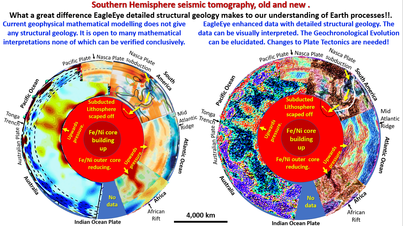
Figure 49. Southern Hemisphere seismic tomography, old and new.

Earth Evolution summary, links to Webinar and Posts 1 to 16.

Figure showing Southern Hemisphere seismic tomography, old and new. A lot of out of the globe research here!! Some of the research results will surprise you! The AusIMM webinar I … [Read More]

Like it? Share it!
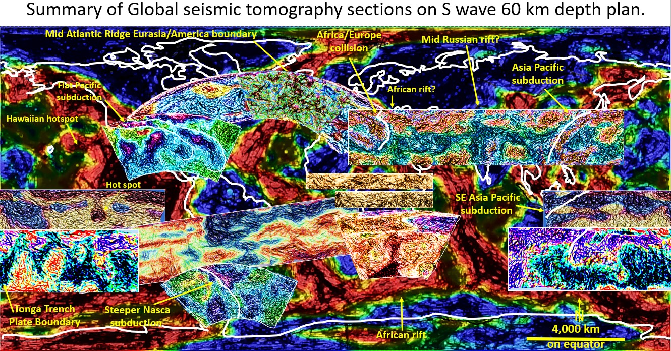
Figure 56. Global summary seismic tomography sections on 60 km depth seismic tomography plan.

Summary and conclusions of the Northern and Southern Hemisphere seismic tomographic sections (part 16).

Figure 56. Global summary of seismic tomography sections superimposed on 60 km depth seismic tomography plan. This figure shows all the Northern and Southern Hemisphere seismic tomographic sections that have … [Read More]

Like it? Share it!
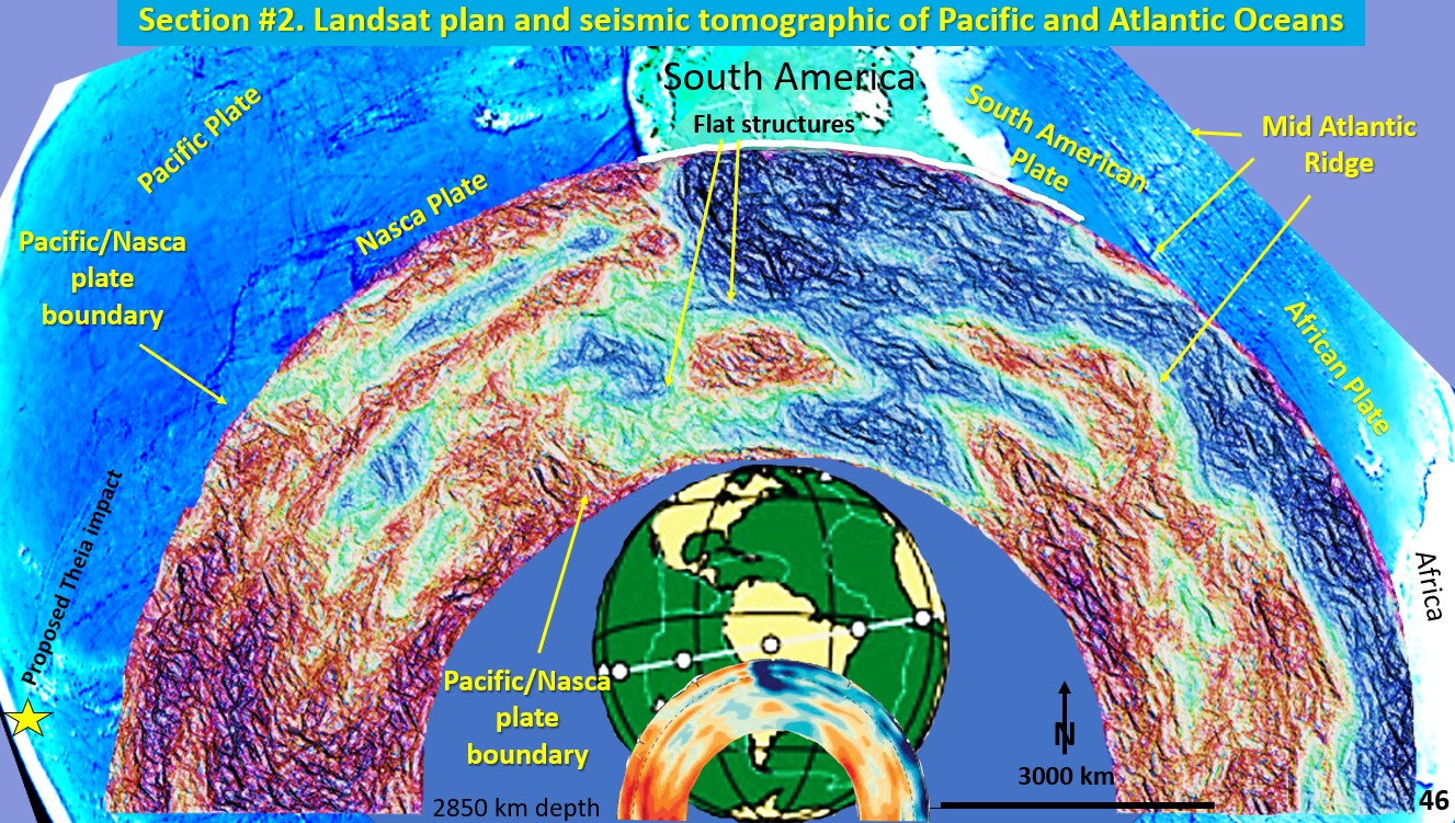
Figure 46. Landsat Plan and seismic tomography section of Pacific Ocean South America and Atlantic Ocean.

Earth Evolution, seismic tomographic from Tonga Trench through to West Africa (Part 13).

Figure 46. Landsat Plan and seismic tomography section of Pacific Ocean South America and Atlantic Ocean. This seismic section extends from the Tonga Trench (yellow star, proposed Theia impact site) … [Read More]

Like it? Share it!