Figure 33. Canadian Abitibi mining area showing the relationship of mines to enhanced seismic tomographic structures.

Abitibi Belt Canada, seismic tomography at 100 km depth. EagleEye ultra-enhancement and exploration targeting. AusIMM webinar, part 5.

The Abitibi belt is one of North America’s largest producers of gold, copper, silver lead zinc and nickel. It would be fantastic to find a new one! The aim of this research is to try and define areas in which to explore, based on sound structural geology evidence.

Like it? Share it!
Figure 29. North America 60 km depth interpreted, enhanced seismic tomography showing linears and rings. Inset of world seismic tomography showing linears and rings.

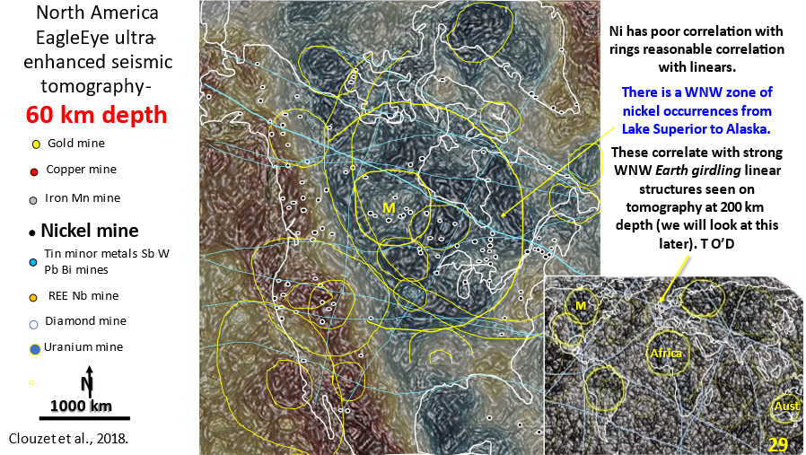
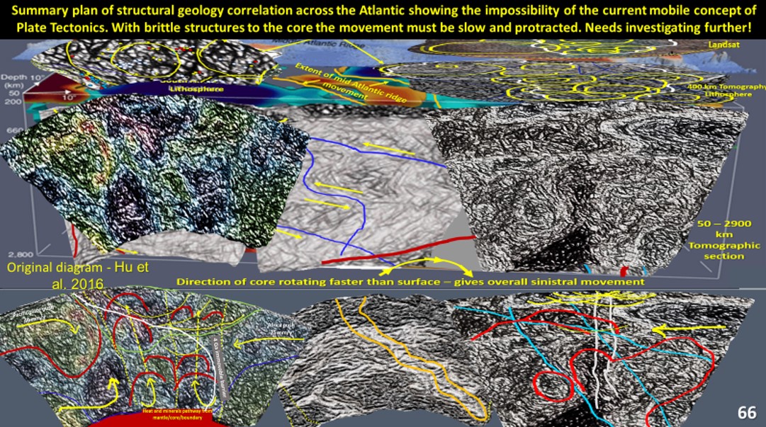
AusIMM North America webinar part 4. Seismic tomography at 60 km depth showing the relationship of the mines to structural geology.

The video link for the AusIMM webinar is below. Look at this video – it will open your eyes to geology most geoscientists only dream about :)! https://www.ausimm.com/videos/community-event/south-west-wageoscience-society—digital-tech-talk-new-discoveries-in-the-structural-geology-mineralization–exploration-targeting-of-north-america/ 6.    Seismic … [Read More]

Like it? Share it!
Pacific - South America - Africa 26°S enhanced seismic tomographic section. Brittle structures shown extending to core.

South America – Africa seismic tomography section 26°S. AusIMM webinar part 13.

South American continent evolution is researched using ultra-detailed Landsat, and seismic tomography. Pacific – South America – Africa 26°S enhanced seismic tomographic section. Brittle structures shown extending to core.

Like it? Share it!