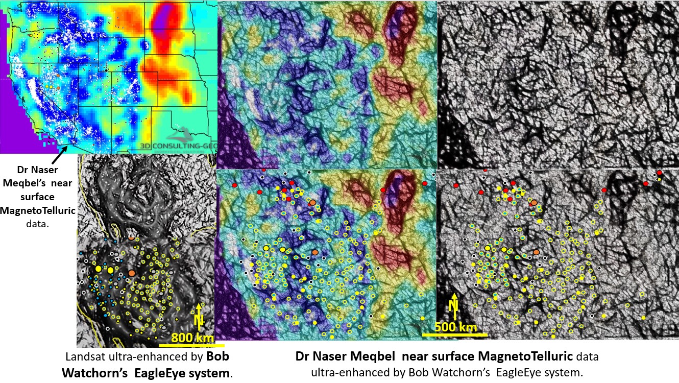
Figure 1. Introduction slide to webinar outlining the new paradigms discovered by my research.

North American geological research using ultra-detailed Landsat, Topography, Magnetics, Gravity and Seismic Tomography from surface to 2,900 km depth. Implications for Plate Tectonics, continent formation, mineralisation genesis and targeting.

North American geological research using ultra-detailed Landsat, Topography, Magnetics, Gravity and Seismic Tomography from surface to 2,900 km depth. Implications for Plate Tectonics, continent formation, mineralisation genesis and targeting.

Like it? Share it!
Naser Meqbel MagnetoTelluric and Landsat comparison using EagelEye syetem

North America structural geology and mineralisation, comparison between Landsat and MagnetoTelluric data.

North America structural geology and mineralisation, comparison between Landsat and MagnetoTelluric data. This paper is an analysis of the different methods of gaining ultra detail from geophysical data.

Like it? Share it!
African Landsat and ultra-detailed Seismic Tomography from 60 - 400 km depth with mines overlaid. Mineralisation pathway on right hand side.

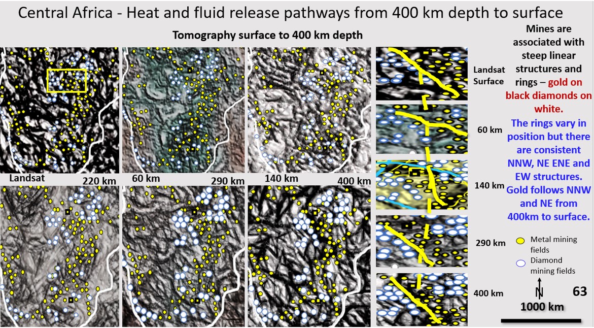
African scavenging and deposition mineralisation pathways from 400 km depth to the current surface. Bob Watchorn Webinar on Africa, Part 10.

  The African Webinar can be viewed at https://vimeo.com/464013825/1ed4a0c752 . Start at about 5 minutes to get straight into it. Figure 63 (above). African Landsat and ultra-detailed Seismic Tomography from … [Read More]

Like it? Share it!