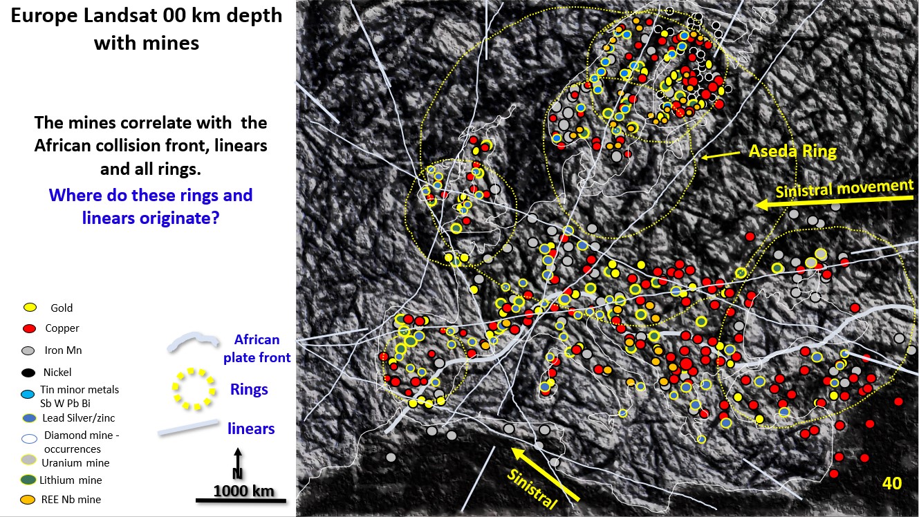
Figure 40. EagleEye enhanced Landsat plan of Europe showing all mines.

European metal mine metallogenetic relationship with the structural geology from EagleEye optimised Landsat Landsat plan. (Part 15).

Figure 40 above. EagleEye enhanced Landsat plan of Europe showing all mines and major linears.  I have never seen a structural geology plan of Europe developed from Landsat. Here is … [Read More]

Like it? Share it!
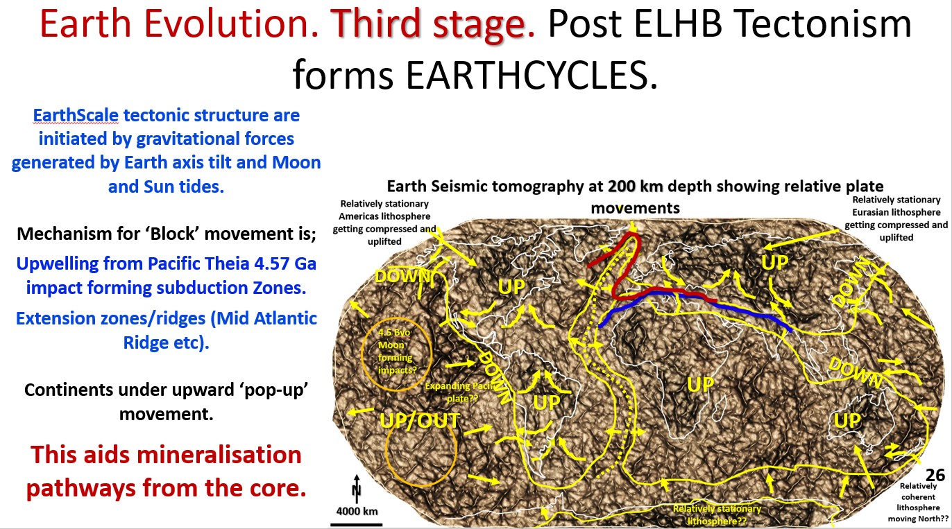
Figure 26. Post Late Heavy Bombardment tectonism forms the first Earth Cycles.

Earth Evolution. Third stage. Post Late Heavy Bombardment Tectonism forms EARTH-CYCLES (part 9).

Figure 26. Earth seismic tomography at 200 km depth showing relative block movements, the mid-Atlantic ridge and global subduction and uplift areas. The AusIMM webinar I did on this new … [Read More]

Like it? Share it!
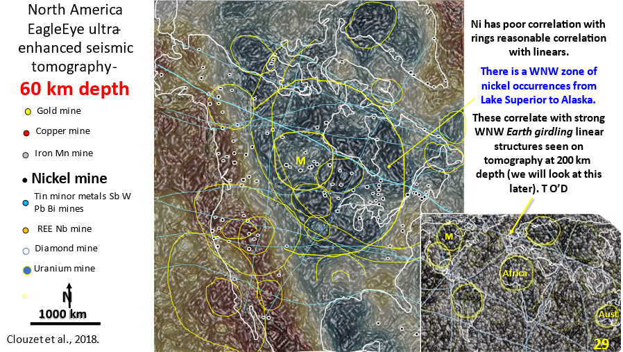
Figure 29. North America 60 km depth interpreted, enhanced seismic tomography showing linears and rings. Inset of world seismic tomography showing linears and rings.

AusIMM North America webinar part 4. Seismic tomography at 60 km depth showing the relationship of the mines to structural geology.

The video link for the AusIMM webinar is below. Look at this video – it will open your eyes to geology most geoscientists only dream about :)! https://www.ausimm.com/videos/community-event/south-west-wageoscience-society—digital-tech-talk-new-discoveries-in-the-structural-geology-mineralization–exploration-targeting-of-north-america/ 6.    Seismic … [Read More]

Like it? Share it!