Fennoscandia Russia seismic tomography structures

Fennoscandia and Russia seismic tomography showing geology of the Asthenosphere Lithosphere boundary from 100 – 270 km depth. Comparison with other continents and the moon.

Fennoscandia and Western Russia geology, using Landsat and the seismic tomography of the Asthenosphere/Lithosphere boundary from 100 – 270 km depth.

Like it? Share it!

Focus on Innovation, AusIMM South West WA Branch – Bob Watchorn Lecture on the genesis of the Archaean cratons and exploration targeting

Focus on Innovation, AusIMM South West WA Branch – Bob Watchorn Lecture on The genesis of the Archaean cratons and exploration targeting

Like it? Share it!
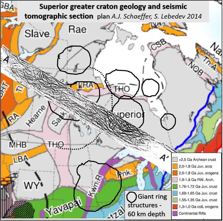
Superior craton geology 60 km interp rings section A A'

CS #1. Superior Craton seismic tomography.

Superior Craton seismic tomography research at 60 km depth and WNW-ESE orthogonal section from Alaska to Lake Ontario and its correlation with Abitibi belt mineralisation. Superior Craton seismic tomography. This … [Read More]

Like it? Share it!