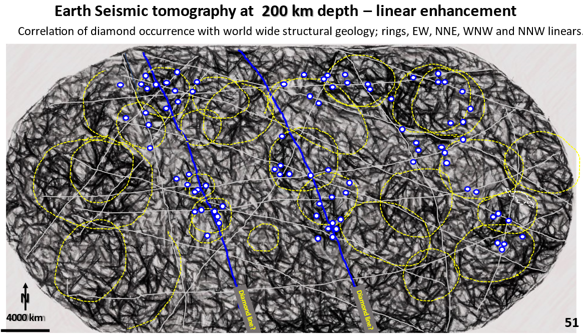
Figure 51. World interpreted, enhanced seismic tomography at 200 km depth showing diamond mines.

Discovering Earth’s geological structure and mineralisation at 200 km depth using Seismic tomography. Currently accepted Plate Tectonics paradigms need questioning! APPLICATION OF DISRUPTIVE INNOVATION. Part 9.

To navigate my geotreks.com.au website go to ARCHIVE in the top menu bar.
Introduce the concept of DISRUPTIVE innovation. The only published Earth-wide research that is currently available in tomography and various other data sources are colour contour based 3-D models, and not structural geology models. The structural geology outlined on the Earth seismic tomography at 200 km depth are Earth-scale (they go over the whole earth) .
The diamond mines follow large rings in North America, South America and Africa. They always lie in the dark areas between the rings. They also follow the large northerly trending arcs and follow EW strong linear structures.. Thus these structures form the basis for worldwide diamond exploration targeting.

Like it? Share it!
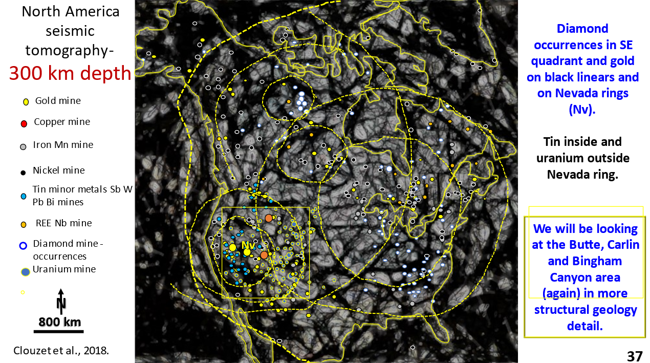
Figure 37. North America interpreted, EagleEye enhanced seismic tomography at 300 km depth with mining fields overlain.

North America Formation and Mineralisation, AusIMM webinar part 6. Research using EagleEye enhancement showing structural geology from the surface to 2,850 km depth.

This is the EagleEye enhanced plan of the 300 km depth seismic tomography.
North American geology is still very brittle at 300 km depth. How can this be possible as we are supposed to be in the middle of the mobile upper mantle? There is a lot of detailed structural geology seen.
If by using this detailed structural geology we can crack why these huge mines are there and what structural geology they follow we will have an exploration plan for finding new fields, in this area and elsewhere in the world!

Like it? Share it!
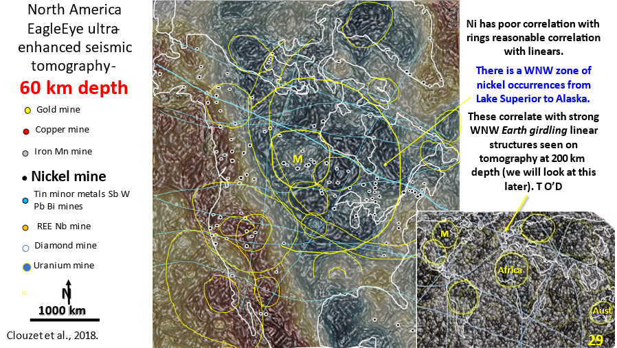
Figure 29. North America 60 km depth interpreted, enhanced seismic tomography showing linears and rings. Inset of world seismic tomography showing linears and rings.

AusIMM North America webinar part 4. Seismic tomography at 60 km depth showing the relationship of the mines to structural geology.

The video link for the AusIMM webinar is below. Look at this video – it will open your eyes to geology most geoscientists only dream about :)! https://www.ausimm.com/videos/community-event/south-west-wageoscience-society—digital-tech-talk-new-discoveries-in-the-structural-geology-mineralization–exploration-targeting-of-north-america/ 6.    Seismic … [Read More]

Like it? Share it!