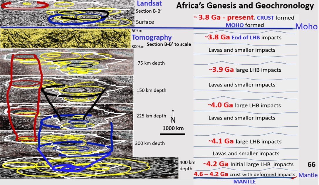
Africa, Vertical stack of African Landsat, Section B and ultra-detailed Seismic Tomography from 60 - 400 km depth. Conceptual evolution of lithosphere on right hand side.

African continent Evolution from a structural geology viewpoint. Last post. Access to total paper of these posts and video link to webinar.

African continent Evolution from a structural geology viewpoint. Access to the total paper of these posts and the link to the video of the webinar.

Like it? Share it!
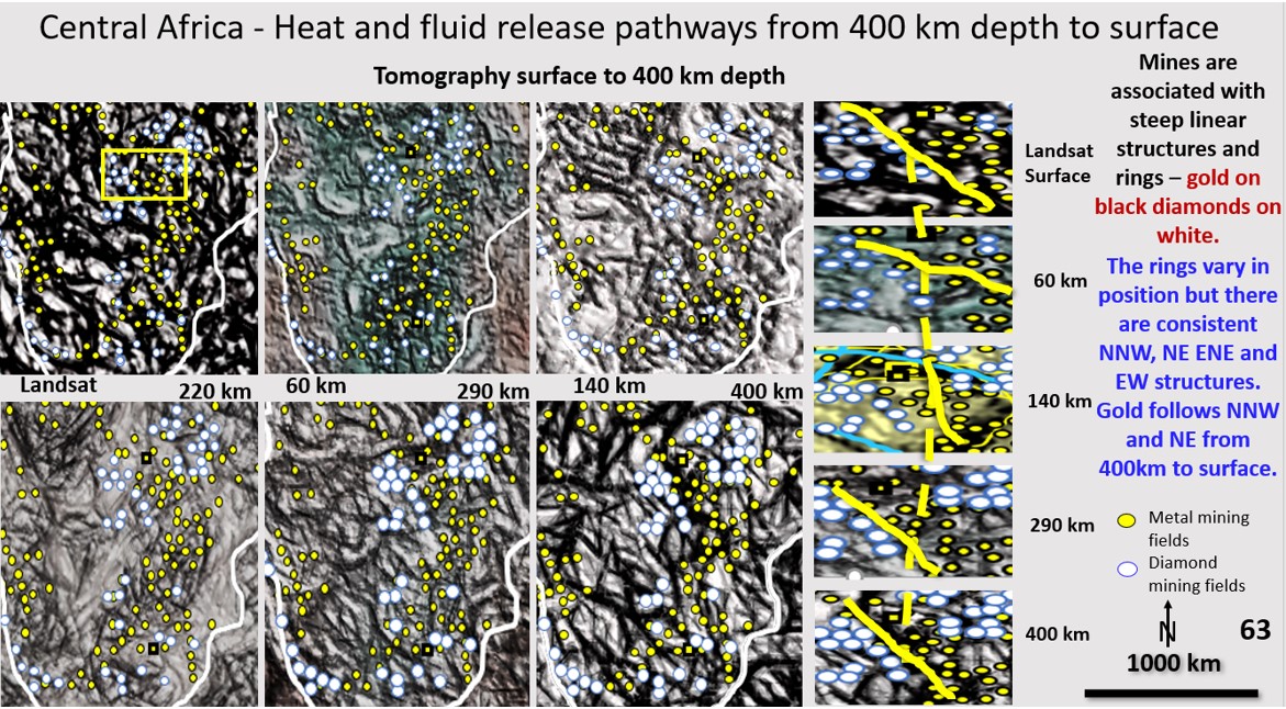
African Landsat and ultra-detailed Seismic Tomography from 60 - 400 km depth with mines overlaid. Mineralisation pathway on right hand side.

African scavenging and deposition mineralisation pathways from 400 km depth to the current surface. Bob Watchorn Webinar on Africa, Part 10.

  The African Webinar can be viewed at https://vimeo.com/464013825/1ed4a0c752 . Start at about 5 minutes to get straight into it. Figure 63 (above). African Landsat and ultra-detailed Seismic Tomography from … [Read More]

Like it? Share it!
Carlin district ultra-detailed tomography at 300 km depth with mines overlaid.

Western Australian, Yilgarn Craton mineral mineral fields and the Carlin/Battle mountain/Butte/Bingham Canyon area in Western USA. Comparing exploration targeting in these fantastically mineralised areas with Africa (section 8).

Research of the tomography of the African continent at 300 km depth. In this section we will be looking at the Australian Yilgarn Craton mineral fields and the Carlin/Battle mountain/Butte/Bingham Canyon area in Western USA using tomography at 300 km depth. We will compare exploration targeting in these fantastically mineralised areas with Africa at 300 km depth seen in the previous section.

Like it? Share it!