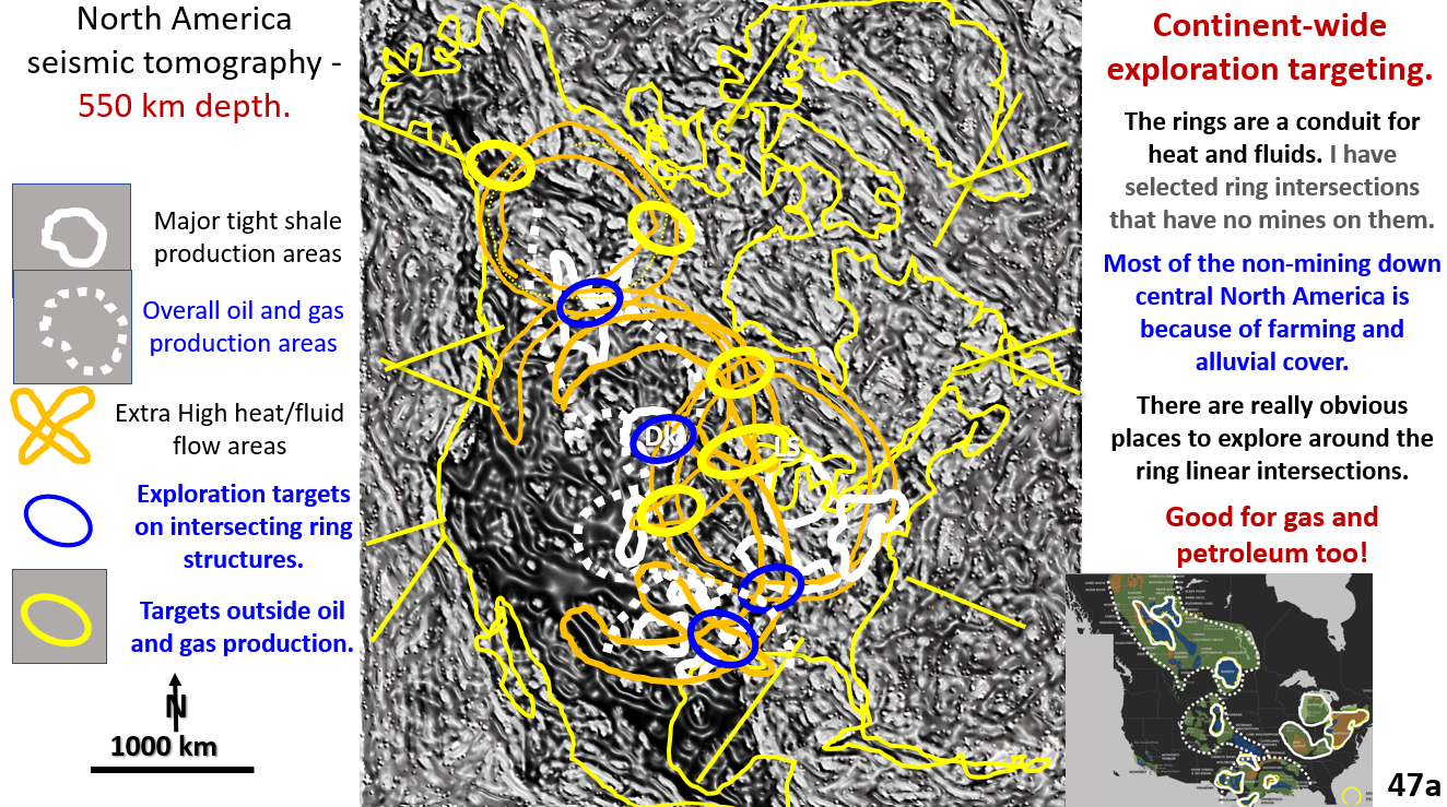
Figure 47a. North America 550 km seismic tomography exploration targeting.

North America metal mine and oil and gas targeting using seismic tomography at 550 km depth. AusIMM webinar part 8.

North American structural geology with exploration targeting plans for oil and gas and metals. Linears and rings show brittle structural geology at 550 km depth – right in the middle of the mobile mantle. See the AusIMM webinar on; https://www.ausimm.com/videos/community-event/south-west-wageoscience-society—digital-tech-talk-new-discoveries-in-the-structural-geology-mineralization–exploration-targeting-of-north-america/ .

Like it? Share it!
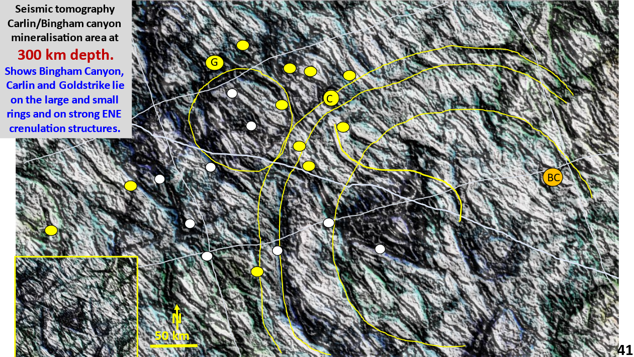
Figure 41. Carlin/Bingham Canyon area interpreted, enhanced seismic tomography at 300 km depth with mines overlain.

Butte/Carlin/Bingham Canyon mining area. EagleEye ultra-enhanced Seismic tomography at 300 km depth. AusIMM webinar Part 7.

Butte/Carlin/Bingham Canyon mining area EagleEye seismic tomography at 300 km depth. Exploration targeting.

Like it? Share it!
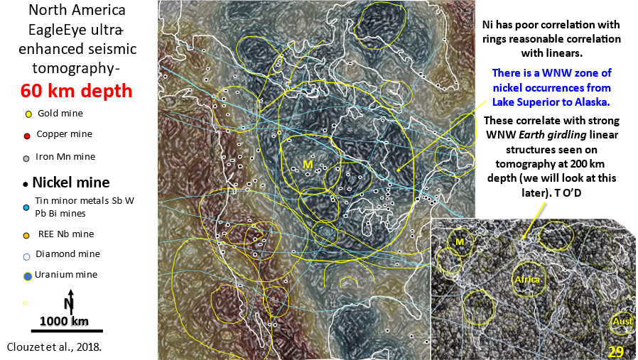
Figure 29. North America 60 km depth interpreted, enhanced seismic tomography showing linears and rings. Inset of world seismic tomography showing linears and rings.

AusIMM North America webinar part 4. Seismic tomography at 60 km depth showing the relationship of the mines to structural geology.

The video link for the AusIMM webinar is below. Look at this video – it will open your eyes to geology most geoscientists only dream about :)! https://www.ausimm.com/videos/community-event/south-west-wageoscience-society—digital-tech-talk-new-discoveries-in-the-structural-geology-mineralization–exploration-targeting-of-north-america/ 6.    Seismic … [Read More]

Like it? Share it!