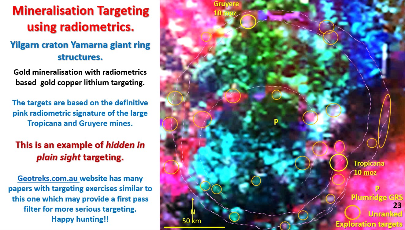
Figure 23. NE Yilgarn Gruyere Tropicana Radiometric targeting.

NE Yilgarn, Yamarna Exploration Targeting using radiometrics, Western Australia. (Part 7).

Figure 23 above. NE Yilgarn Gruyere – Tropicana Radiometric targeting. This paper examines using radiometrics for targeting gold mineralisation. The above figure, from 2017, shows mineralisation targeting using radiometrics around … [Read More]

Like it? Share it!
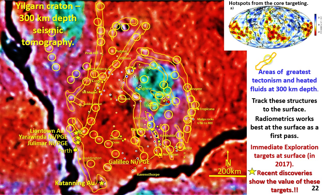
Figure 22. Yilgarn Seismic tomography, 300 km depth. hotspot Exploration targeting.

8. Global Exploration techniques. Targeting in the Yilgarn Craton Western Australia (Part 6).

We will now get into the exploration targeting section of the talk and will start with Australia, down on the lower-right corner of the next figure. This plan shows the … [Read More]

Like it? Share it!
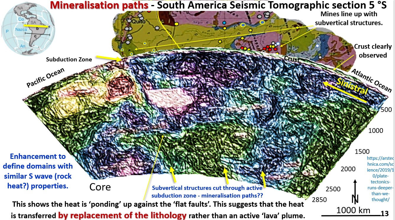
Figure 13. Mineralisation paths - South America Seismic Tomographic section 5 °S

7. Global mineralising systems. Mineralisation paths through subduction zones in South and North America (Part 5).

Figure 13. Mineralisation paths – South America Seismic Tomographic section 5 °S. This figure is of the subduction zone under South America at 5° South. The current mobile mantle hypothesis … [Read More]

Like it? Share it!