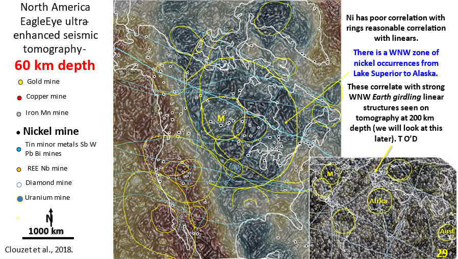
Figure 29. North America 60 km depth interpreted, enhanced seismic tomography showing linears and rings. Inset of world seismic tomography showing linears and rings.

AusIMM North America webinar part 4. Seismic tomography at 60 km depth showing the relationship of the mines to structural geology.

The video link for the AusIMM webinar is below. Look at this video – it will open your eyes to geology most geoscientists only dream about :)! https://www.ausimm.com/videos/community-event/south-west-wageoscience-society—digital-tech-talk-new-discoveries-in-the-structural-geology-mineralization–exploration-targeting-of-north-america/ 6.    Seismic … [Read More]

Like it? Share it!
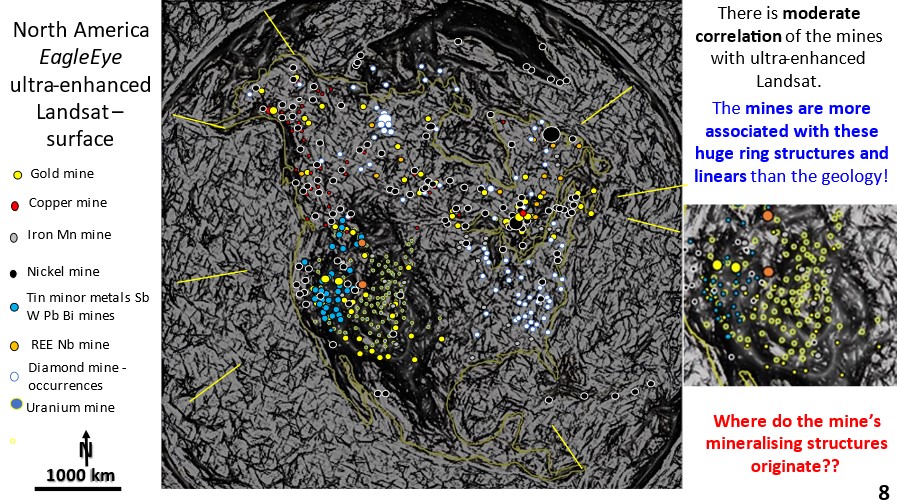
Figure 8. North America Landsat ultra-enhanced image showing large rings and their relationship to mining fields.

North America AusIMM Webinar. Part 2. Landsat EagleEye ultra-detailed research of structural geology correlation with mineralisation.

North America. Landsat EagleEye ultra detailed research of structural geology correlation with mineralisation. The mines are plotted onto the Landsat image. Find out, in this series of posts, how to do exploration targeting from the continental scale right down to the mine scale – all from continental scale original data!

Like it? Share it!
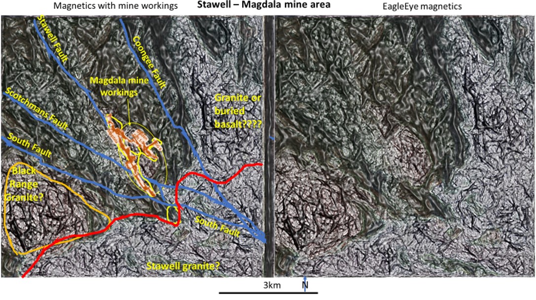
Magdala mine workings with interpreted Magnetics and uninterpreted magnetics from the showing the Stawell goldfield.

Stawell gold mining area; Mine Scale Exploration Targeting using EagleEye enhancement of magnetics in plan and section.

Victoria, Stawell gold mining area; Mine Scale Exploration Targeting using EagleEye enhancement of magnetics in plan and section.

Like it? Share it!