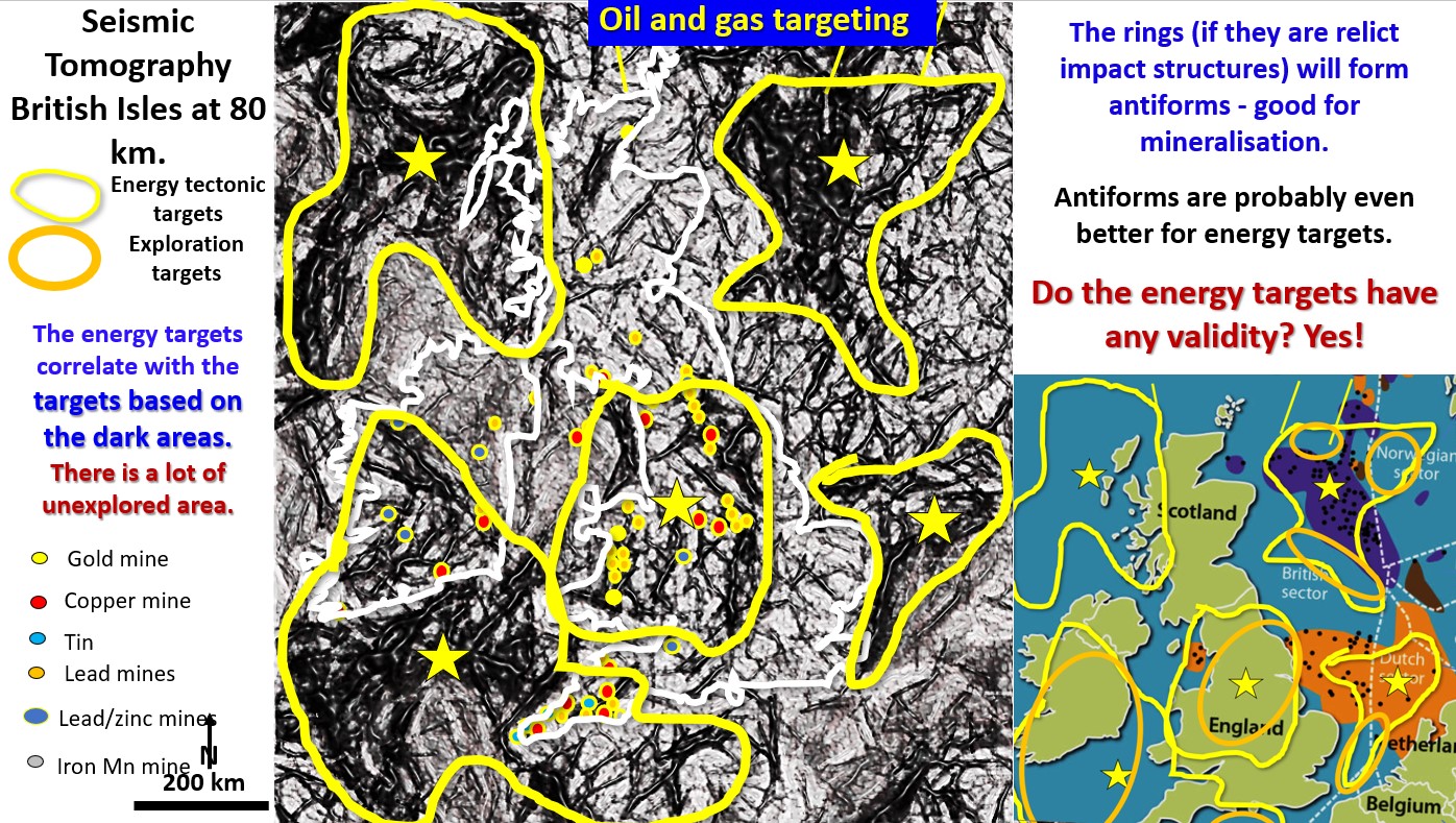
Figure 60. British Isles EagleEye seismic tomography at 80 km oil gas targeting.

17.     British Isles oil and gas formation and exploration targeting using seismic tomography at 80 km depth. (Part 21).

Figure 60 above. British Isles  EagleEye seismic tomography at 80 km oil gas targeting. The above figure shows the seismic tomography of the British Isles and the North Sea at … [Read More]

Like it? Share it!
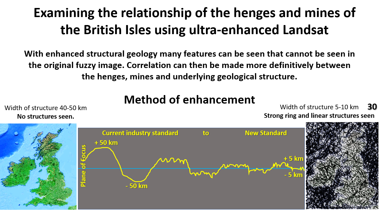
Figure 30. Examining the relationship of the henges and mines with the structural geology of the British Isles using EagleEye ultra-enhanced Landsat.

Examining the relationship of the henges and mines with the structural geology of the British Isles using EagleEye ultra-enhanced Landsat. Part11.

The relationship of the henges and mines with the structural geology of the British Isles using EagleEye ultra-enhanced Landsat. Relationship henges mines with structural geology British Isles EagleEye

Like it? Share it!