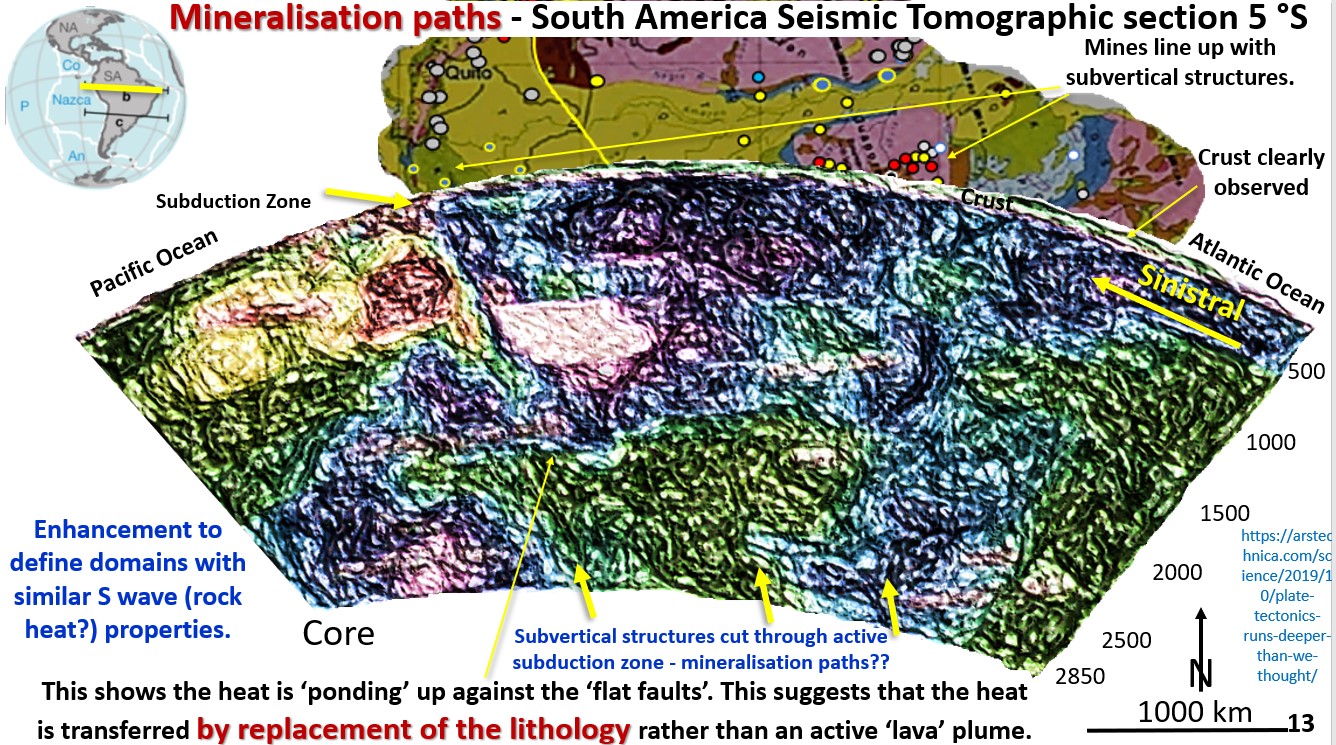
Figure 13. Mineralisation paths - South America Seismic Tomographic section 5 °S

7. Global mineralising systems. Mineralisation paths through subduction zones in South and North America (Part 5).

Figure 13. Mineralisation paths – South America Seismic Tomographic section 5 °S. This figure is of the subduction zone under South America at 5° South. The current mobile mantle hypothesis … [Read More]

Like it? Share it!
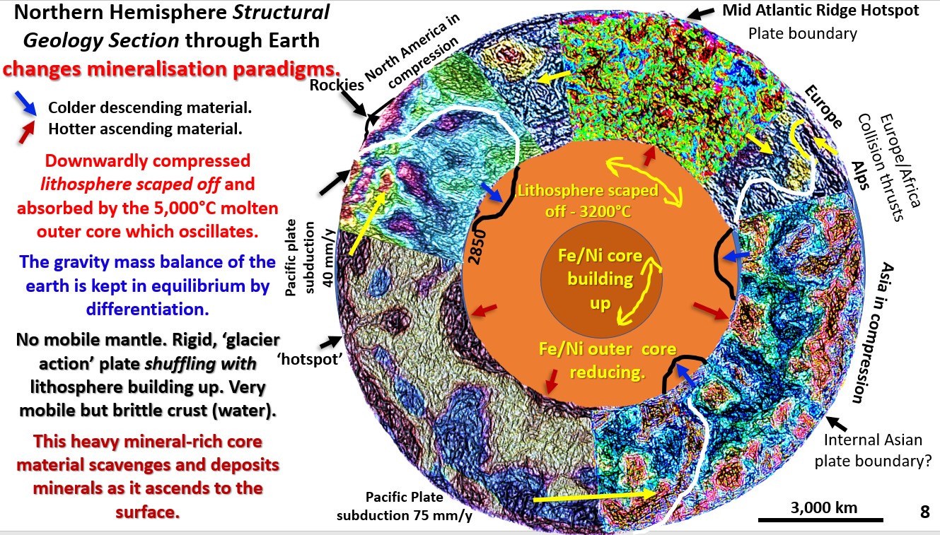
Figure 8. Northern Hemisphere EagleEye structural geology.

4. Global structural geology knowledge is a precursor to understanding global mineralising and exploration targeting systems (Part 4).

Figure 8. Northern Hemisphere EagleEye enhanced seismic tomography structural geology sections showing the subduction zones and extensional rifts and ridges. This figure is one that I have never seen in … [Read More]

Like it? Share it!
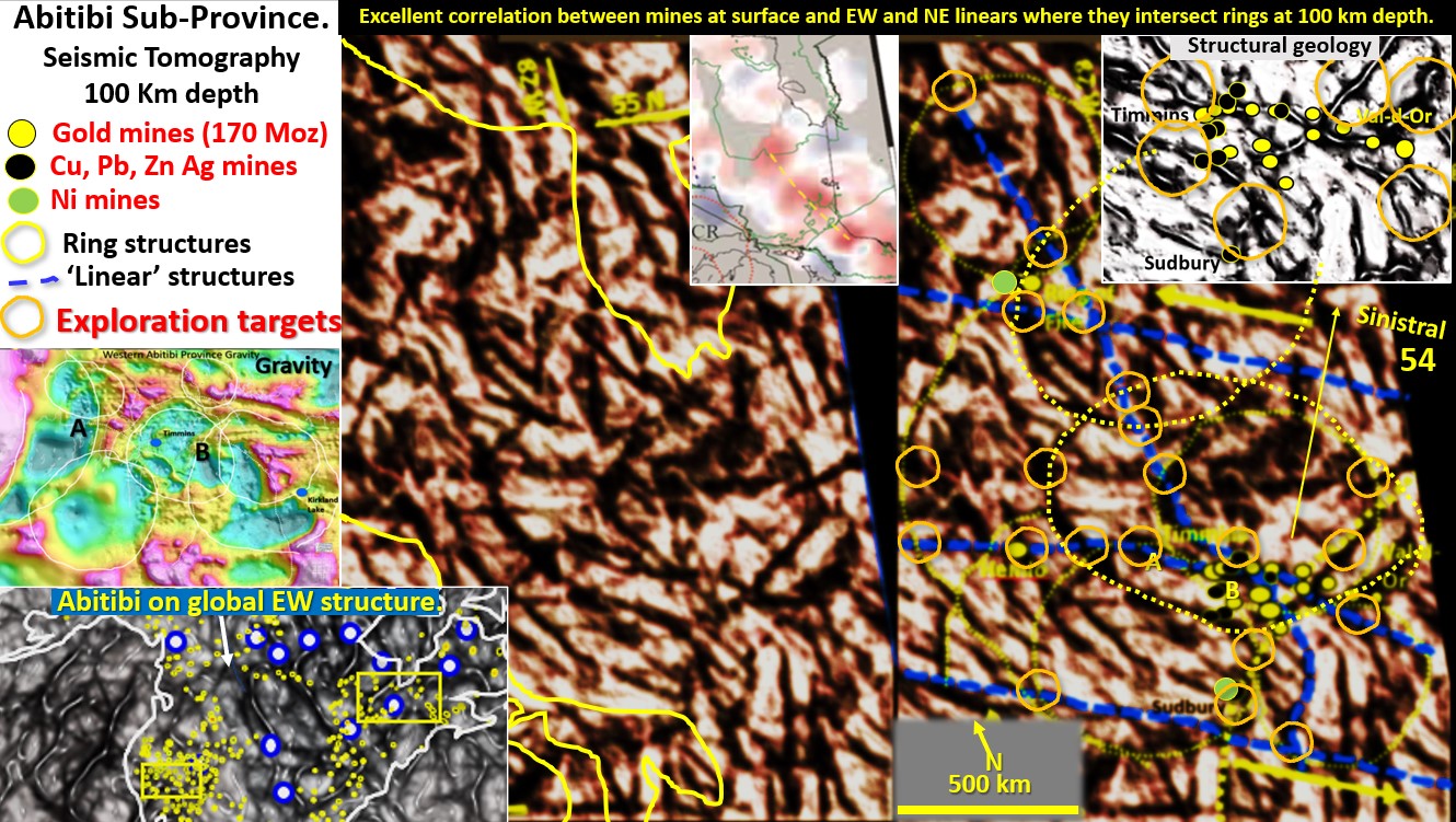
Figure 54. Abitibi and Ring of Fire districts' seismic tomography at 100 km depth with exploration targeting..

Abitibi and Ring of Fire districts’ seismic tomography at 100 km depth with exploration targeting. (Part 18).

Figure 54 above. Abitibi and Ring of Fire districts’ seismic tomography at 100 km depth with exploration targeting. The Abitibi belt is one of North America’s largest producers of gold, … [Read More]

Like it? Share it!