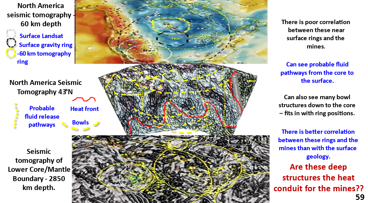
Figure 56. North America interpreted, enhanced seismic tomographic plan at 550 km depth and section showing mines and mineralisation pathways from core to surface.

North America enhanced 550 km depth seismic tomography plan and cross section 36N. Part 11.

View the Webinar at – https://www.ausimm.com/videos/community-event/south-west-wageoscience-society—digital-tech-talk-new-discoveries-in-the-structural-geology-mineralization–exploration-targeting-of-north-america/ .
Earth’s evolution. Seismic tomography at 550 km depth shows major discontinuities (450-650 km depth). These are probably the tops of Ultra-Large Igneous Provinces (ULIPs) formed from the earliest huge impacts. It is suggested that these impacts were associated with the planet-sized bolide impact 4.56 billion years ago that spalled off the moon.
Mineralisation. The cross-section shows strong structural pathways from the core, at 5,000°C to the surface, at 20°C. The core is where I believe the mineralising fluids forming the mines ascended.
Where to from here? If my EagleEye system (or similar) were used by the general geoscience industry to get the detailed structural geology of the earth, from the surface to the core, a huge advance in our knowledge of Earth, and mineralisation, would occur.

Like it? Share it!
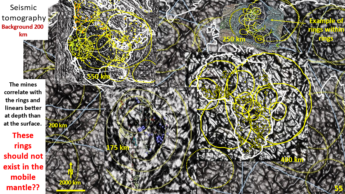
Figure 55. America, Europe and Africa area interpreted, enhanced seismic tomography showing geological structure and mines.

Western Hemisphere seismic tomography at 175 to 550 km depths showing giant ring structures. AusIMM webinar Part 10.

Visit the AusIMM Webinar at https://www.ausimm.com/videos/community-event/south-west-wageoscience-society—digital-tech-talk-new-discoveries-in-the-structural-geology-mineralization–exploration-targeting-of-north-america/ .
Seismic tomographic research under North and South America, Africa and Eastern Europe from 170 – 550 km depth shows giant ring structures. It is suggested these formed before or during the Late Heavy Bombardment from 4.1 to 3.8 billion years ago. They exist from the surface down to at least 600 km depth. These relatively undeformed rings occur in the supposed mobile mantle. So, Earth down to 600 km depth is not mobile and so the evolution of Earth by earth-wide Plate Tectonics cannot be correct and needs revision.

Like it? Share it!
Figure 51. World interpreted, enhanced seismic tomography at 200 km depth showing diamond mines.

Discovering Earth’s geological structure and mineralisation at 200 km depth using Seismic tomography. Currently accepted Plate Tectonics paradigms need questioning! APPLICATION OF DISRUPTIVE INNOVATION. Part 9.

To navigate my geotreks.com.au website go to ARCHIVE in the top menu bar.
Introduce the concept of DISRUPTIVE innovation. The only published Earth-wide research that is currently available in tomography and various other data sources are colour contour based 3-D models, and not structural geology models. The structural geology outlined on the Earth seismic tomography at 200 km depth are Earth-scale (they go over the whole earth) .
The diamond mines follow large rings in North America, South America and Africa. They always lie in the dark areas between the rings. They also follow the large northerly trending arcs and follow EW strong linear structures.. Thus these structures form the basis for worldwide diamond exploration targeting.

Like it? Share it!