North American geological research using ultra-detailed Landsat, Topography, Magnetics, Gravity and Seismic Tomography from surface to 2,900 km depth. Implications for Plate Tectonics, continent formation, mineralisation genesis and targeting.
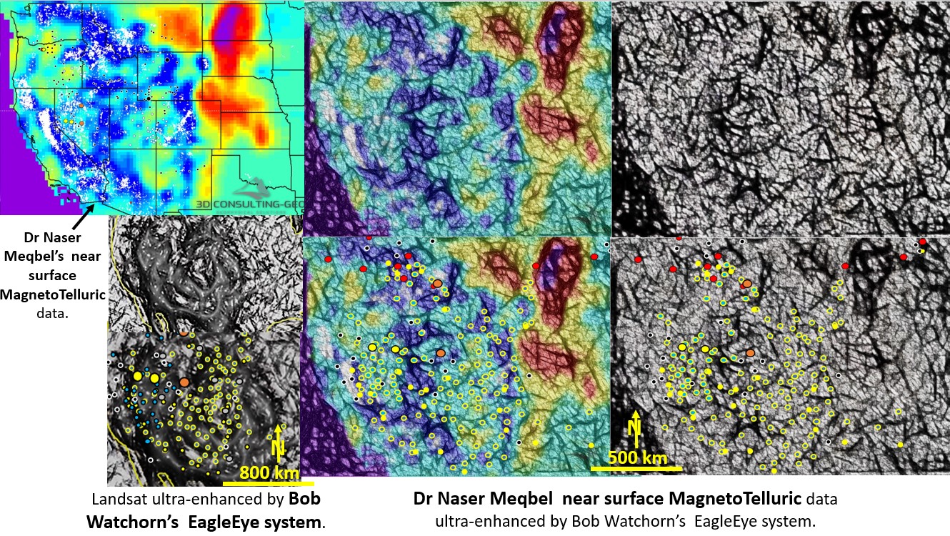
North America structural geology and mineralisation, comparison between Landsat and MagnetoTelluric data. This paper is an analysis of the different methods of gaining ultra detail from geophysical data.
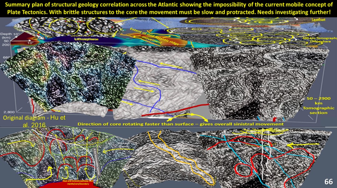
South American continent evolution is researched using ultra-detailed Landsat, and seismic tomography. Pacific – South America – Africa 26°S enhanced seismic tomographic section. Brittle structures shown extending to core.