Figure 60. Stacked sections of North America from outer core to surface with inset of moon for comparison.

North America stacked sections – gravity, seismic tomography 60 to 2850 km depth and Lunar surface. Part 14. Verification of my ‘EagleEye’ structures showing examples.

Figure 60. Stacked sections of North America from outer core to surface with inset of Lunar Mares for comparison. Read the annotations on the above figure before you start the … [Read More]

Like it? Share it!
Figure 59. North America interpreted, enhanced seismic tomographic plans at 60 km depth and outer core plan at 2850 km depth with cross-section 36°N.

North America Seismic Tomography plans at 60 km and 2,850 km depths with joining seismic tomography cross-section. AusIMM webinar Part 13.

Figure 59 (above). North America interpreted, enhanced seismic tomographic plans at 60 km depth and outer core at 2850 km depth with cross-section 36°N. This figure summarises my concept of … [Read More]

Like it? Share it!
Figure 56. North America interpreted, enhanced seismic tomographic plan at 550 km depth and section showing mines and mineralisation pathways from core to surface.

North America enhanced 550 km depth seismic tomography plan and cross section 36N. Part 11.

View the Webinar at – https://www.ausimm.com/videos/community-event/south-west-wageoscience-society—digital-tech-talk-new-discoveries-in-the-structural-geology-mineralization–exploration-targeting-of-north-america/ .
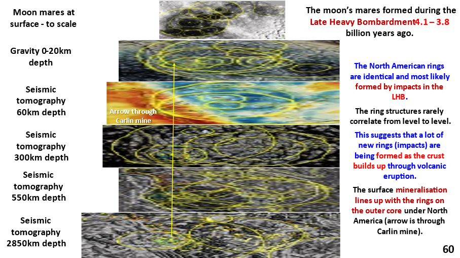
Earth’s evolution. Seismic tomography at 550 km depth shows major discontinuities (450-650 km depth). These are probably the tops of Ultra-Large Igneous Provinces (ULIPs) formed from the earliest huge impacts. It is suggested that these impacts were associated with the planet-sized bolide impact 4.56 billion years ago that spalled off the moon.
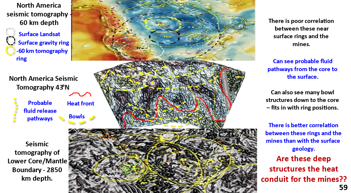
Mineralisation. The cross-section shows strong structural pathways from the core, at 5,000°C to the surface, at 20°C. The core is where I believe the mineralising fluids forming the mines ascended.
Where to from here? If my EagleEye system (or similar) were used by the general geoscience industry to get the detailed structural geology of the earth, from the surface to the core, a huge advance in our knowledge of Earth, and mineralisation, would occur.

Like it? Share it!