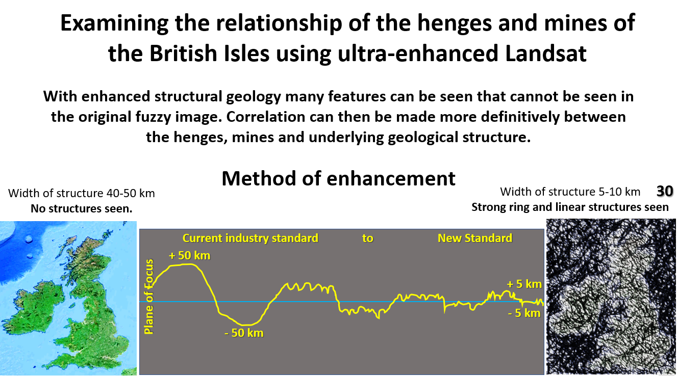
Figure 30 above. Examining the relationship of the henges and mines with the structural geology of the British Isles using EagleEye ultra-enhanced Landsat.
The see the figures more clearly enlarge the post!
This, the 11th in a a series of posts for the many Archaeologists among my contacts, is based on a transcript of the AusIMM webinar on ‘Did copper mining kickstart advanced civilisation’.
We will be examining the relationship of the henges and mines to the broad structure of the British Isles using ultra-enhanced Landsat obtained by the EagleEye method.
**** See the lecture on YouTube – https://www.youtube.com/watch?v=aGiV3gNFPI8
EagleEye enhancement method.
The EagleEye method enables very detailed structures, that relate to the geology and geography of the British Isles, to be extracted from ‘fuzzy’ original data.
The method involves using software that locates, sharpens up and enhances the structural geology so that it can be visualised in detail.
See my website posts
on the EagleEye method and its results.
The left-side plan in the above figure 30 is the original Landsat used and on the right-side plan is the ultra-enhanced structural geology result. Can others get this detailed structural geology result? I’m interested to find out. So far, I haven’t seen similar results published.
The structural geology of the British isles from Landsat.

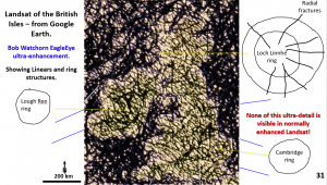
This figure shows the ultra-enhanced Landsat (original from Google Earth) of the British Isles.
Apart from the many linears, there are at least three giant ring structures seen. I am not speculating on the origin of the ring structures.
In Scotland, centered around the Isle of Skye is what I call the Loch Linnhe ring. The central ring is about 200 km in diameter and the outside ring which clips Northern Ireland is about 500 km in diameter and encompasses all of Scotland.
The centre of the next most visible ring is, once again, about 200 km in diameter. It is centered at Lough Ree in the centre of Ireland. The eastern half of this ring extends from Cornwall up through the centre of England and back around to the top of Ireland (about 700 km in diameter).
In the lower-right corner of the plan is the Cambridge Ring in the Wash area of Great Britain.
Henge correlation.
We will now examine the relationship of the henges to these huge structures.

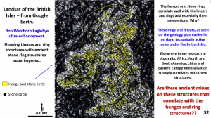
This plan shows ultra-enhanced Landsat of the British Isles with the henges superimposed.
The rings described in figure 31 are shown as yellow circles.
Of interest is the ENE trend of the main geology and the fact that the henges correlate very well with the ENE and WSW quadrants of the major ring structures. There are few henges on the west side of the rings. This is similar to the activity on the rings in the Yilgarn Craton in Western Australia – why? Does it signify an active eastward movement direction and subsequent mineralisation activity?
The henges also correlate with the intersections of the major rings with linears.
These rings and linears lie on dark zones. In Landsat this may mean shear zones, more vegetation, more iron rich, valleys or anything that makes the Earth’s surface darker.
However, this is the same structural regime as I’ve seen in my research in all the other continents. Why do the henges correlate with these ring and linear structures in this enhanced Landsat?
One very interesting ring in the lower-right corner of the plan is the Cambridge Ring in the Wash area of Great Britain. There are henges closely following the rings of the Cambridge Ring.
This area is fairly flat country and there is no reason why the henges should have been built in this circular fashion. Why did they build them in this circular fashion?
Mine correlation.
Next question – do the mines correlate with the henges and ring and linear structures in this enhanced Landsat?

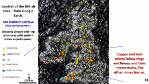
This plan shows the mines’ correlation to the rings and linears.
It is observed that the Irish ring has the closest correlation with mines. The large eastern arc of this ring structure has a lot of mines around it from Scotland through central England down to Cornwall. The best and most abundant mines are where the strong NS linears intersect the rings.
There are also areas along the rings where there are henges with no apparent mines.
There are henges closely following the rings of the Cambridge Ring and yet there are no known mines in the area. Were there originally shallow, rich copper showings at the surface near the henge locations which were mined out? Maybe we can use these henge locations as a geochemical tool for finding new mines?
Conclusion
The henges and mines correlate well with each other and with the eastern side of the rings and where rings intersect with other rings and with linears.
Thus part of the hypothesis (of the close spatial relationship between the henges mines and structural geology) to prove that copper mining was more important in catalysing civilisation than early agriculture stands up to scrutiny in the British Isles.
Next post.
Is this close correlation a coincidence?
Another aim of the research is to define the deeper structures that the mines follow. If there are structures at depth that the copper mines correlate with this firms up the structures seen in Landsat at the surface. Maybe not a coincidence??
To do this we will go down to 80 km depth and use seismic tomography to firm up the structures – or otherwise!
However, at 80 km depth we should now be at the top of the mobile mantle and there should be no brittle structures observed. Is this what we will find in the next post?
Follow this exploratory journey and share it with your colleagues!
Cheers
Bob Watchorn

