Superior craton geology 60 km interp rings section A A'

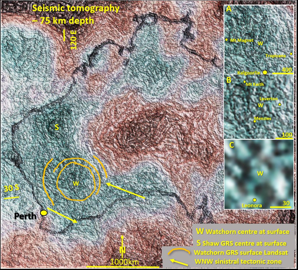
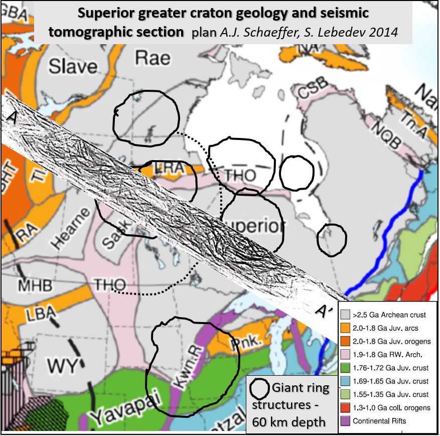
CS #1. Superior Craton seismic tomography.

Superior Craton seismic tomography research at 60 km depth and WNW-ESE orthogonal section from Alaska to Lake Ontario and its correlation with Abitibi belt mineralisation. Superior Craton seismic tomography. This … [Read More]

Like it? Share it!

YW #9. Yilgarn seismic tomography; geology and mineralisation on -75 km depth plan, EW section 30˚S and NS section 120˚E

Yilgarn craton geology is now being understood more clearly through this paper. This paper describes the structural geology, mineralisation and geochronology of the earth 75 km below the current surface using enhanced seismic tomology. A 2D picture can be gained from the two orthogonal cross sections on 30 S and 120 E. This is the first time the seismic tomography data has been used in such detail.

Like it? Share it!

YW #8. Yilgarn geology and mineralisation, correlation of linear structures and giant ring structures with -75 km depth seismic tomography.

Yilgarn geology research. This paper is the result of 45 years research of the Yilgarn by the author. This research is (gradually) changing the fundamental way in which the geology … [Read More]

Like it? Share it!