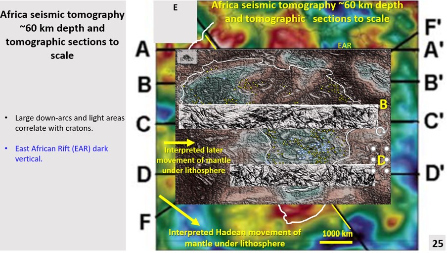
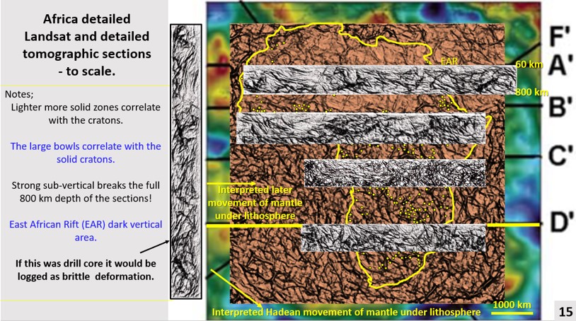
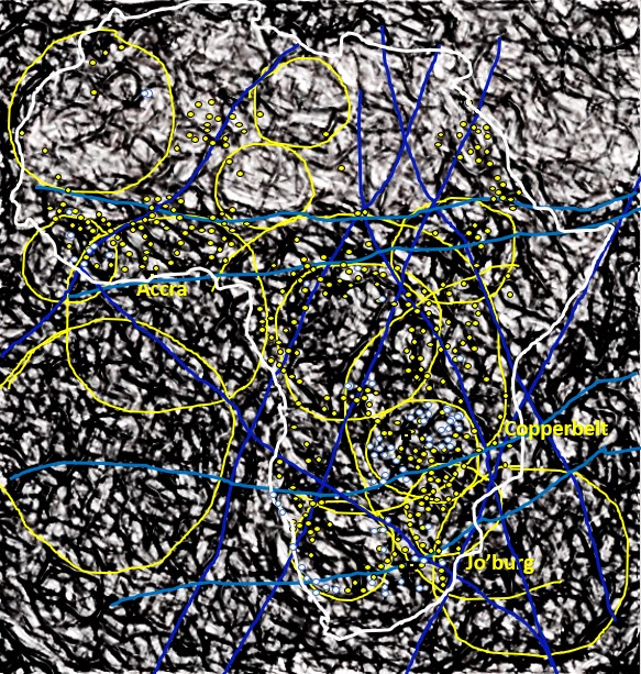
Africa Landsat enhancement. African Continent Evolution research using ultra-detailed Landsat and Seismic Tomography from surface to 2,900 km depth. Implications for Plate Tectonics, continent formation and the genesis and targeting of mineralisation