Earth Evolution, Northern Hemisphere research. Seismic tomographic from Borneo through to Eastern Pacific Plate (Part 14).
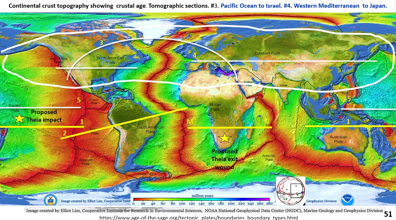
Figure 51. Seismic tomography sections from North America through Europe to Japan. The AusIMM webinar I did on this new research can be seen on the AusIMM website or on … [Read More]