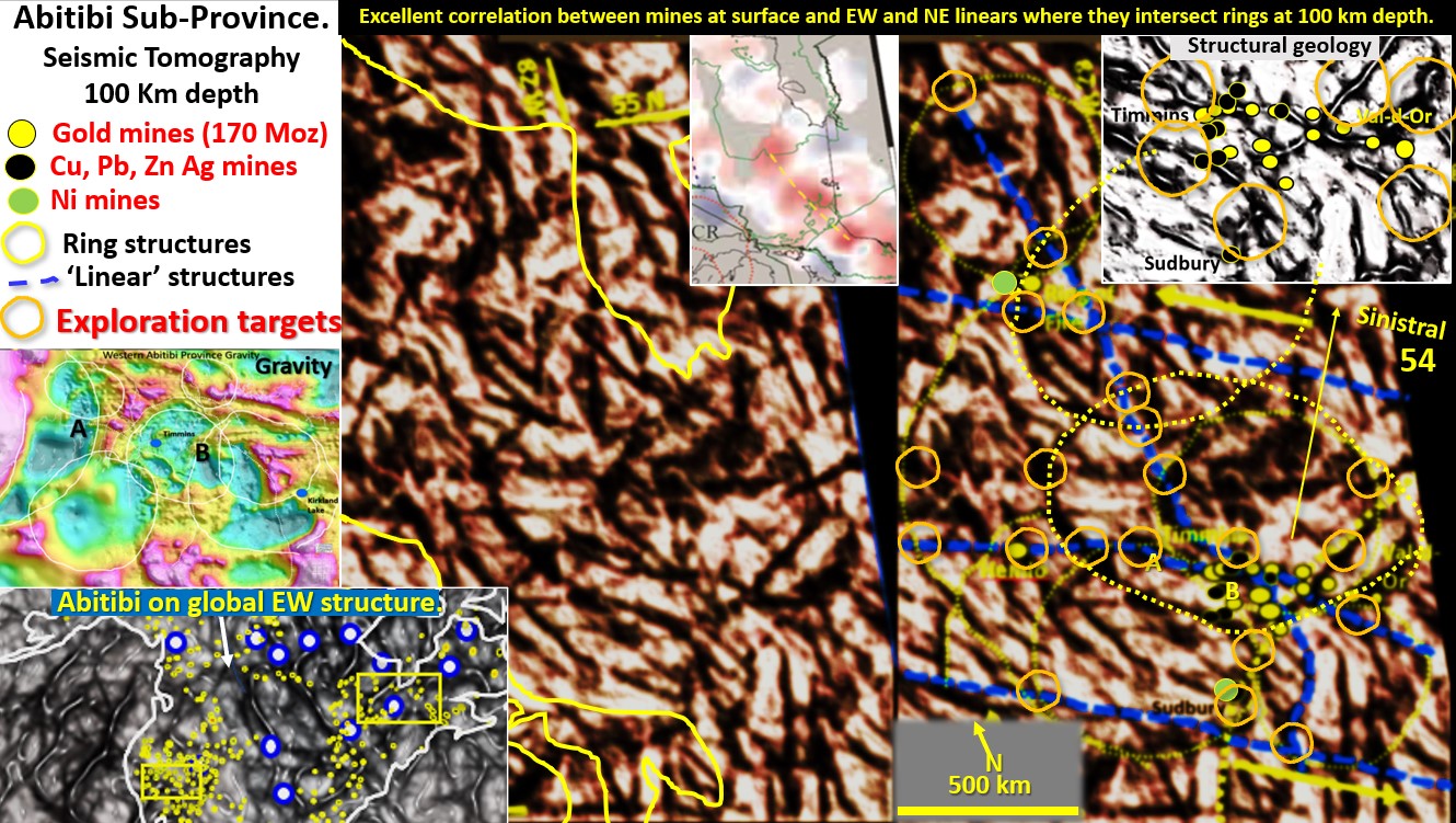
Figure 54 above. Abitibi and Ring of Fire districts’ seismic tomography at 100 km depth with exploration targeting.
The Abitibi belt is one of North America’s largest producers of gold, copper, silver lead zinc and nickel. It would be fantastic to find a new one!
So, the aim of this exercise is to define areas in which to explore, based on sound structural geology evidence.
The gravity plan, middle-left (Peschler et al., 2006.) shows rings near the surface in the Abitibi belt and is what first piqued my interest in this area. The lower-left plan shows the Abitibi belt runs EW and there are strong EW structures observed at this 100 km depth in the seismic tomography. Abitibi sits on a huge EW structure on the -200 km depth seismic tomography plan (figure 50) that may not have been recognised before and which extends right around the Northern Hemisphere. There are mines right along this structure.
I have found elsewhere that the mines are more associated with the deeper rings and structures than those on the surface. Therefore, I used seismic tomography at 100 km depth (original image centre-top) to see if there were ring structures in another dataset. Rings were quite visible.
At 100 km depth there is a 1,500 km diameter ring to the NW of the Abitibi belt with smaller 500 km diameter rings encompassing the Abitibi belt and the Ring of Fire deposits (centre left). The Abitibi belt is in the SE quadrant of the big ring structure and is mainly associated with WNW and NE linears.
The two right hand images show Abitibi mines superimposed on these ring structures. The top-right image has been fined tuned to show the major structures at 100 km depth and when the mines are plotted on it they lie directly over these major structures. This is further evidence of the vertical transmission of the superheated fluids that form these mines. This is becoming a very certain pattern.
For exploration targeting around Abitibi, and up to the Ring of Fire next to Hudson Bay I would be following the shear zones (linears) and particularly where those linears intersect the rings as that is where Abitibi formed and where the Ring of Fire mineralisation forms (orange targets).

