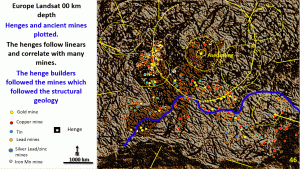
The ancient civilisations would have known nothing about the structural geology and therefore if farming was the primary reason for the commencement of ancient civilisation then the henges should follow the prime farming areas!
Instead, the henges are often in the more mountainous areas where the biggest and richest ancient mines were located. This is clear evidence that mining precipitated the start of advanced urbanised civilisation over Europe and not farming.
Of interest in this plan is the centre of the Aseda ring where the henges follow in the annulus between the centre and the first ring. There was only a limited time period in this area between the retreat of the ice and the flooding of the land for ancient civilisations to develop.
In the area is not covered by alluvium there are mines. Are there buried mines under the alluvium in northern Germany and the Baltic States and Denmark? Is this a good exploration targeting rationale for these areas?
EagleEye enhancement of the Seismic tomography of Europe from 100 to 600 km depth.
Will now look at the seismic tomography from 100 to 600 km steps very briefly to see if the same rationale holds true as in the British Isles.
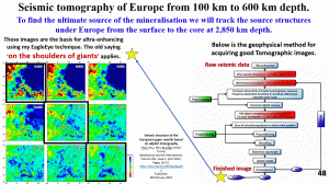
This next section is more of a geological section than an archaeological section and we will be trying to find the ultimate source of the mineralisation by tracking source structures from the surface to the outer core at 2850 km depth.
The three black outlined images at 100, 300 and 600 km depths will be enhanced using Eagle eye.
These starting images are the result of an intricate geophysical process for acquiring good tomographic images (see right-hand table). So, I stand on the shoulders of geophysical giants!
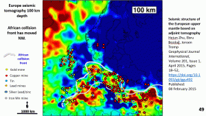
At 100 km depth most of the ancient richest mines lie in the African Europe collision front.
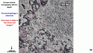
This is the EagleEye enhancement at 100 km depth of the seismic tomography. There is an interesting orthogonal pattern over eastern Europe with a NW and NE direction of structures the WNW spiral structure is very clearly visible.
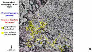
When the henges are plotted onto the seismic tomography plan at 100 km depth it can be observed that the ENE, WNW, NE and NW structures are followed most closely by the henges.
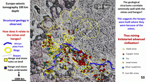
This suggests that the mines, which the henges are following, are possibly generated from fluids following structures from the 100 km depth.
I have found in my research of seismic tomography at various levels under the continents that the mineralising fluids follow different structures at different levels.
The most obvious rings and linear structures are plotted on this plan.
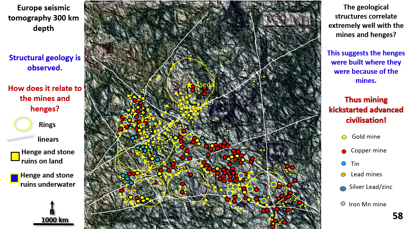
When the mines are plotted on and your toggle back-and-forth between the figure of 51 and 52 many of the henges are covered by the mines. This shows the close correlation between them. This is especially true in areas of good relief where there would have been outcropping native copper.
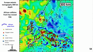
This plan of the seismic tomography at 300 km depth shows that the African-Europe collision front has moved NW under the British Isles and southern Scandinavia.
The ancient mines in Britain and southern Scandinavia most likely originated from this depth as they are neatly enclosed by the collision front outline at 300 km depth.
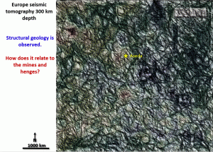
In this plan the turbulent, brittle flow of the African collision can be seen which contrasts with the more linear darker area to the NE and NW.
All over the plan at 300 km depth there are ring structures of various sizes.
I am not supposing that any or all of these are impact structures but suspect they are related to the flow of the collision.
However, the largest rings still occur up near the Aseda ring in Sweden and this depth may be the base of the impact that formed this ring seen in Landsat. Once again good correlation between different datasets.
The WNW and ENE strong linear structures are particularly visible on this plan. NNW and NS structures in the Italy, Britain and Scandinavian area are also clearly observable.
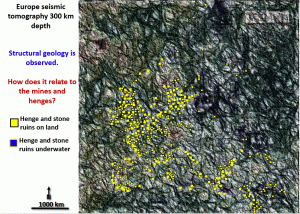
When the henges are plotted it can be seen that they are still following the ENE and NW trends very strongly ranging from in the top left, the Scottish Hebrides henge system, the southern England Stonehenge through to Denmark system and down in the lower left from north Africa through to Greece system.
However the henges now follow the ring structures more closely and there are a lot more henges where the ring structures intersect these NNW, NE, NW and NS linears.
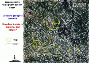
This figure shows the major linears and ring structures at 300 km deep.
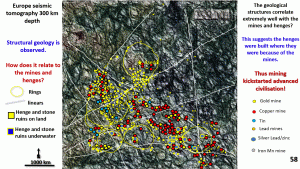
Once again once the mines are plotted it can be seen that they follow the same rings and linears that the henges are on.
Cheers
Bob
Share this with any Archaeologist you know.

