8. Seismic tomography diamond targeting exercises in South America.

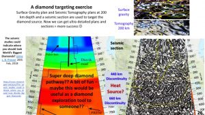
I was looking through the images in Google to try and find a seismic section through a diamond field. This image by Presser 2018 looked like a tomographic image through a diamond field even showing the depths from which various types of diamonds come from. I am not sure where it is located – probably South Africa?
The two plans at top-right show how the diamonds occurred on worm structures and on ring structures. If all this data is put together when this makes an excellent targeting tool for diamonds.
So, a challenge for those geoscientists that want to make a name for themselves as mine finders! If you can duplicate this type of tomographic cross-section at 10 km intervals in orthogonal directions and tomographic plans at 20 km depth intervals, and have the capacity to ultra-enhance them, then you will be progressing towards discovering productive, new diamond fields.

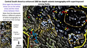
This plan or seismic tomography at 200 km depth shows the relationship of the diamond mines to the lighter coloured areas in the lithology. The orange outline shows where I would be targeting for diamonds.
Although the lighter coloured areas in the lithology look like stratigraphy, I don’t believe they represent stratigraphy but are the topography of Hadean lava flows. In the next plan I’ll show you why I think this.
9. Earth and Venus – correlation of lithosphere/crust.

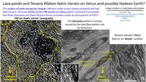
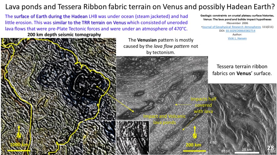
This figure shows the Earth’s lithosphere at 200 km depth on the left and the surface of Venus on the right.
Vicky Hanson in 2016 gave a great masterclass on the Tessera Ribbon fabric terrain (TRR) on Venus. As I’ve been researching the tomography of the lithosphere on the various continents it kept reminding me of this TRR on Venus. It is well worth studying Vickie’s papers – very interesting!
The Venusian TRR structures are caused by the very hot, dense and static atmosphere which allows the lava to cool very slowly without erosion (Hansen 2006).
During the Late Heavy Bombardment Earth was covered with a deep ocean (Wilde et al., 2001) and the lava produced after the impact would have been pressure steam jacketed and therefore the lava would have cooled very slowly – perhaps at similar pressures and temperatures to Venus. Both lithospheres would have been formed under ambient, non-erosive conditions.
The left image shows the tomography of Earth at 200 km depth.
In the Venus central image one can see that the lava-flows grew from the bottom and were progressively overlaid as you progress up the image. There are two ring ‘impact’ structures covered by lava on their top side. The dark areas represent lava lakes. On Earth large igneous provinces (LIPs) are attributed to impacts (Jones 2005). A comparison of the two small insets in the bottom centre, of Earth and Venus, show that the structural geology looks identical.
The right-hand image shows the complicated patterns of the Venus lava flows. Was the apparent complicated pattern of the Earth’s Lithosphere be caused by an Earth TRR? the effect of slicing it horizontally would be like enhancing wood grain by sawing sub-parallel to the grain.
Do the dark homogeneous areas in the Earth’s lithosphere represent lava lakes as they do on Venus.
Comment – it’s worth searching far and wide when researching geology as the natural laws are universal.
If you have some interesting, tricky questions to tackle me with I’d love it! See the comment button below.
Happy diamond and Venus hunting!
Cheers
Bob

