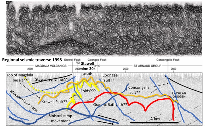
Watchorn EagleEye enhanced seismic section 97 AGS V2 - 20 km N of Stawell

Stawell Goldfield; Mine Scale Exploration Targeting using EagleEye enhancement of magnetics in plan and section. Part 1, Regional magnetics section interpretation.

Stawell Goldfield; Mine Scale Exploration Targeting using EagleEye enhancement of magnetics in plan and section. Part 1, Regional magnetics section interpretation.

Like it? Share it!
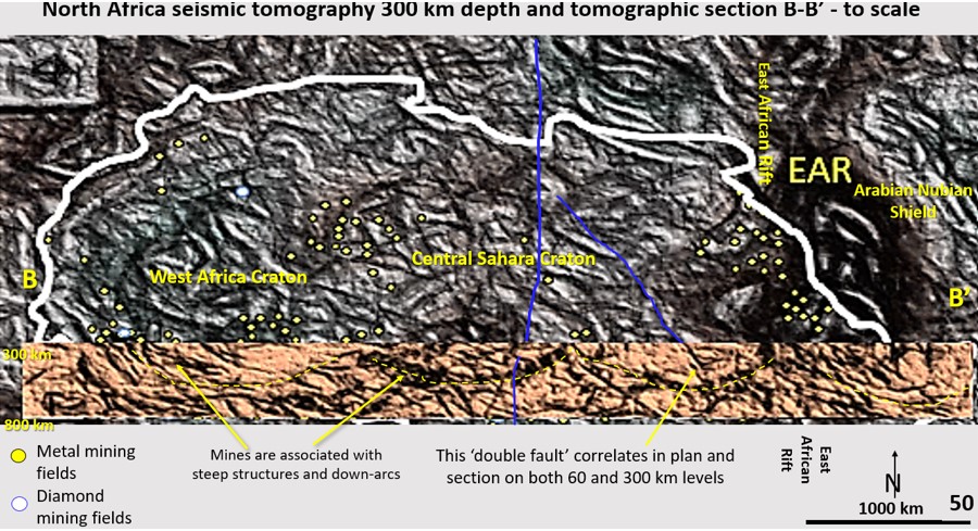
Africa tomographic and Tomography at 300 km depth

Part 7. African Continent Evolution research using ultra-detailed Landsat and Seismic Tomography from surface to 2,900 km depth. Implications for Plate Tectonics, continent formation and the genesis and targeting of mineralisation

African Continent Evolution research using ultra-detailed Seismic Tomography at 300 km depth. Implications for Plate Tectonics, continent formation and the genesis and targeting of mineralisation

Like it? Share it!
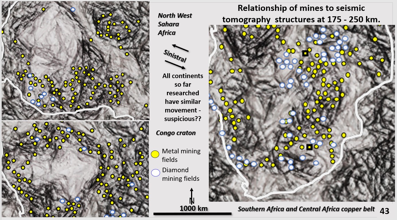
African seismic tomography at 215 km depth showing ultra- detailed structure association with mines, rings and linears.

Part 6. African Continent Evolution research using ultra-detailed Landsat and Seismic Tomography from surface to 2,900 km depth. Implications for Plate Tectonics, continent formation and the genesis and targeting of mineralisation. © Bob Watchorn July 2020

Africa is a rich source of minerals. The main mining fields in Africa are located on the ring structures and linears from the surface right to the limits of detailed data at 400 km depth. The mechanism and source of the fluid for most mineralisation may have been discovered by this research.

This Part 6 section describes the relationship of the metal and diamond mineralisation to the linear and ring structures observed in African seismic tomography at 170-250 km depth. Africa is a rich source of minerals. The main mining fields in Africa are located on the ring structures and linears from the surface right to the limits of detailed data at 400 km depth.

Like it? Share it!